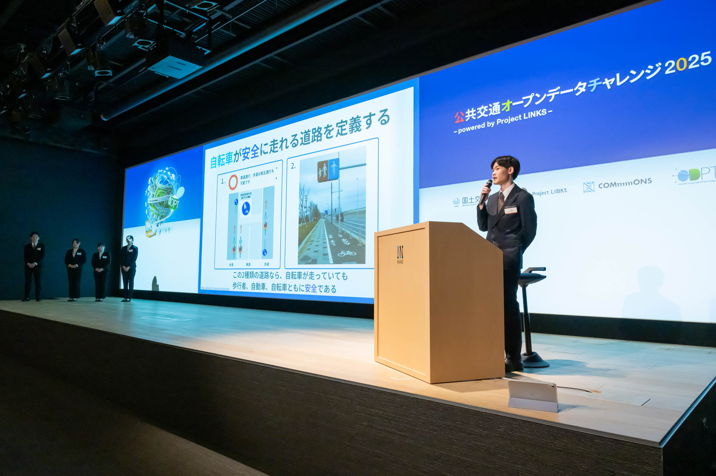
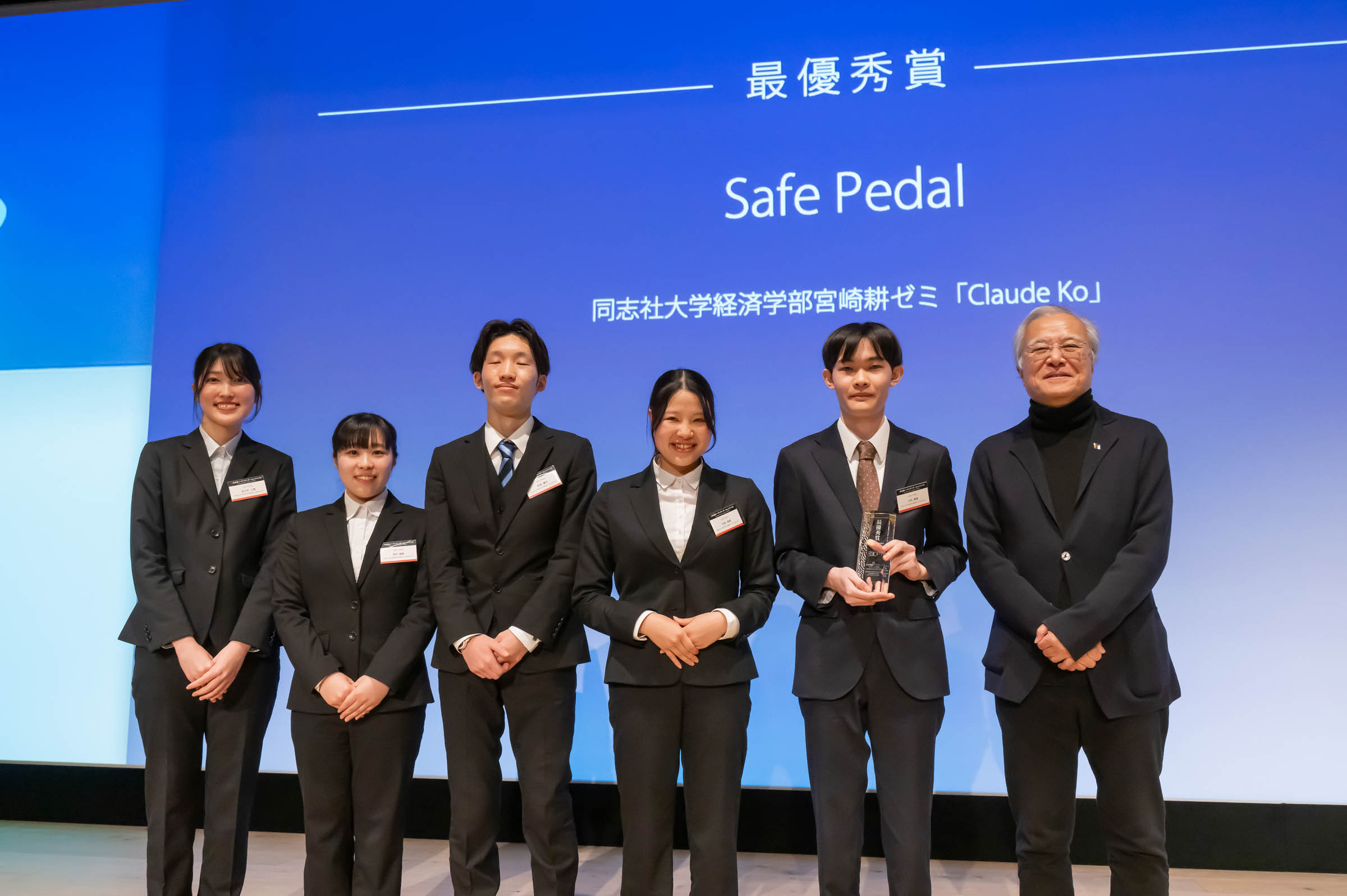
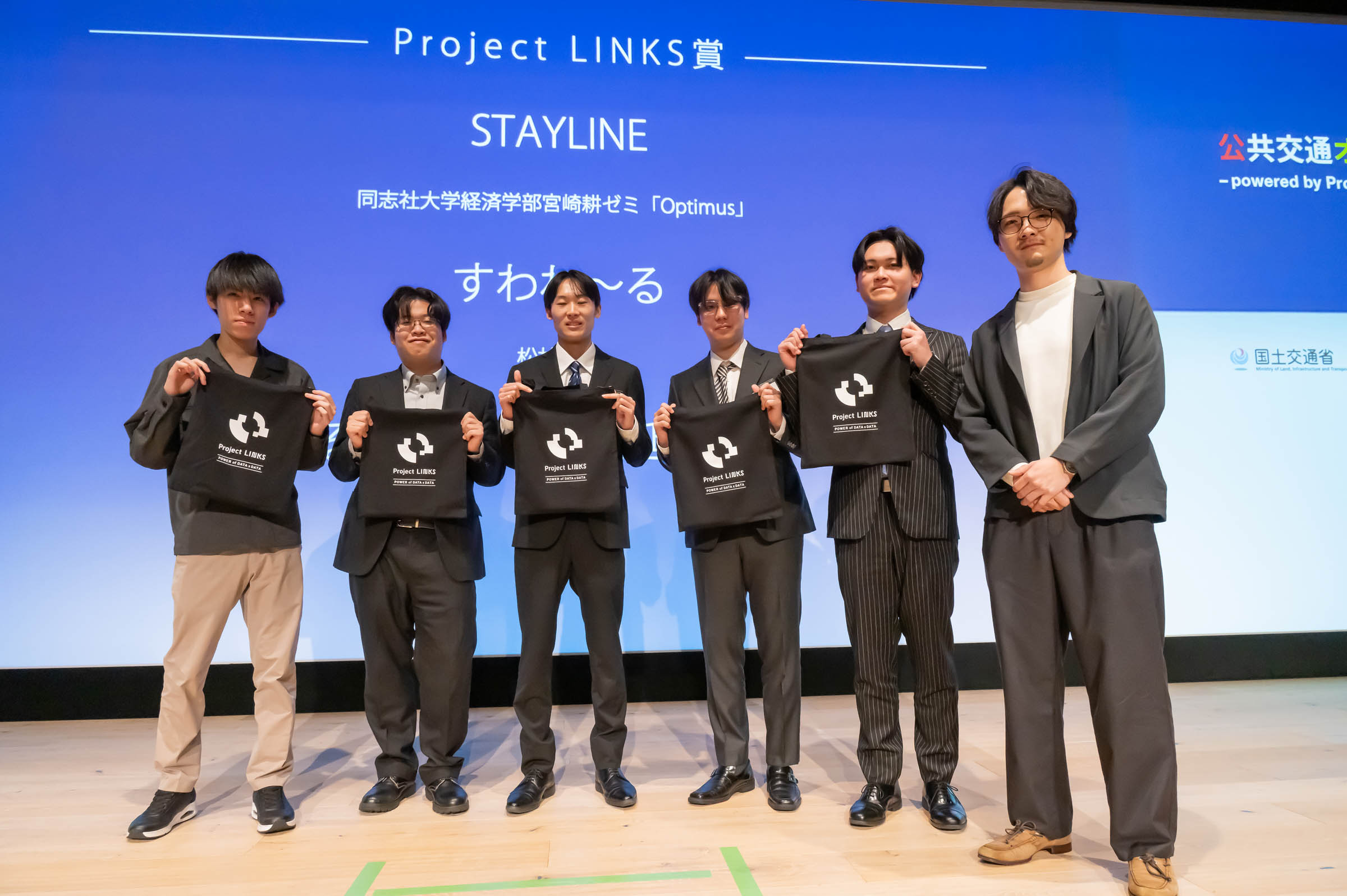
"Claude Ko" Aoi Kawauchi, Ryota Kobayashi, Hibiki Mikawa, Yuzuki Kawamura, Kenta Niwa, Koyuki Sasaki, Minori Nakata, from Miyazaki Kou Seminar, Faculty of Economics, Doshisha University
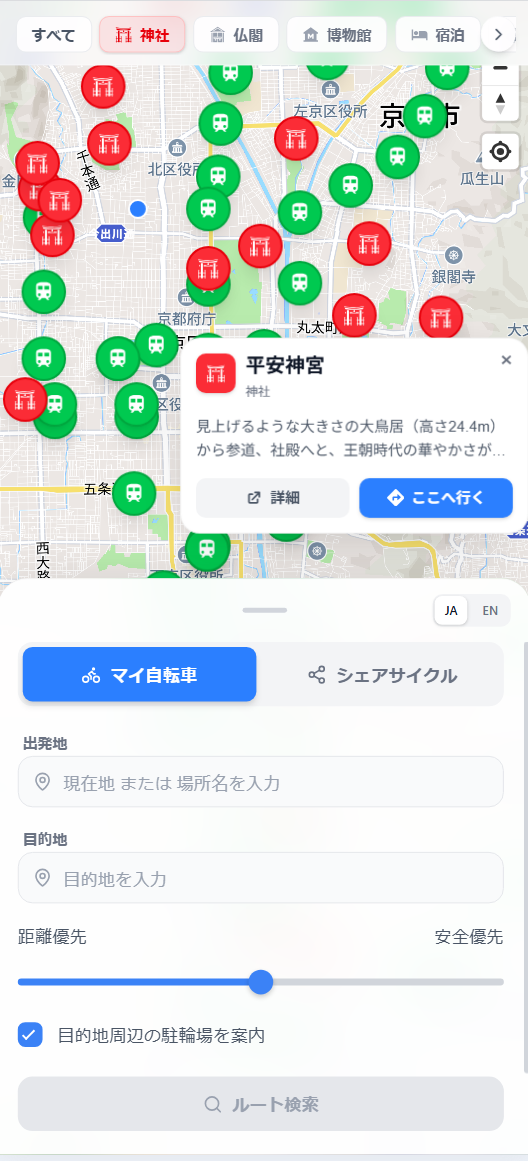
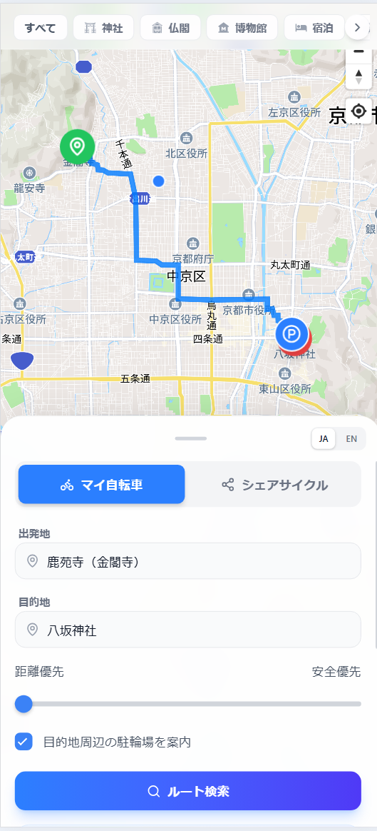
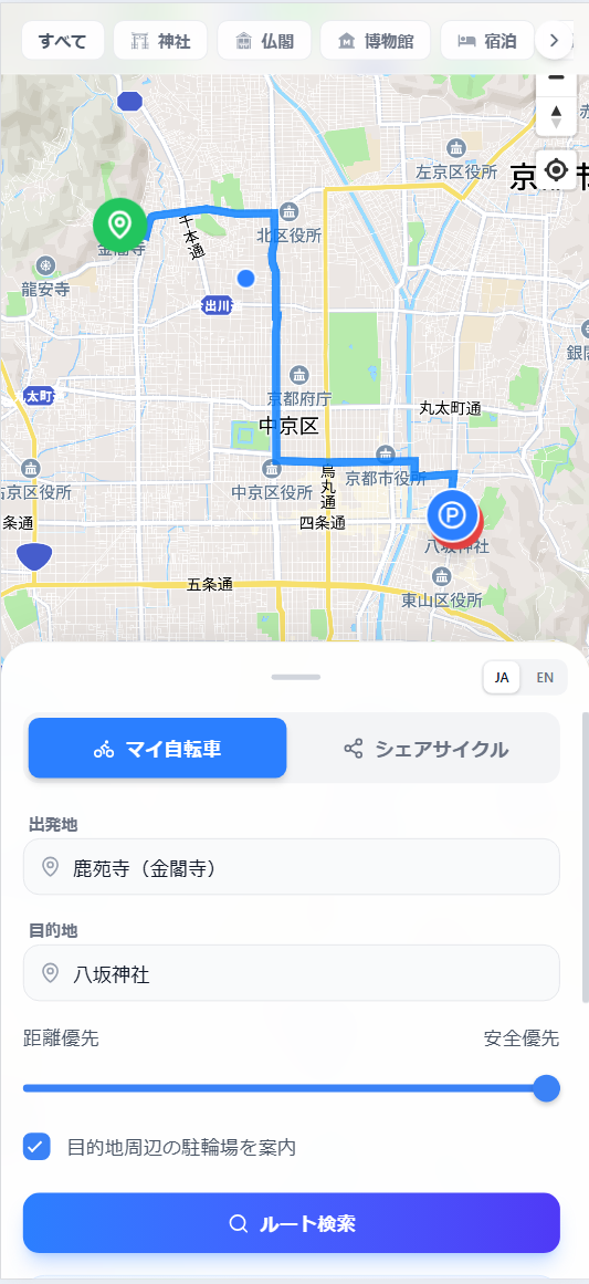
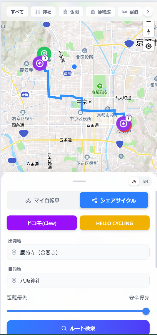
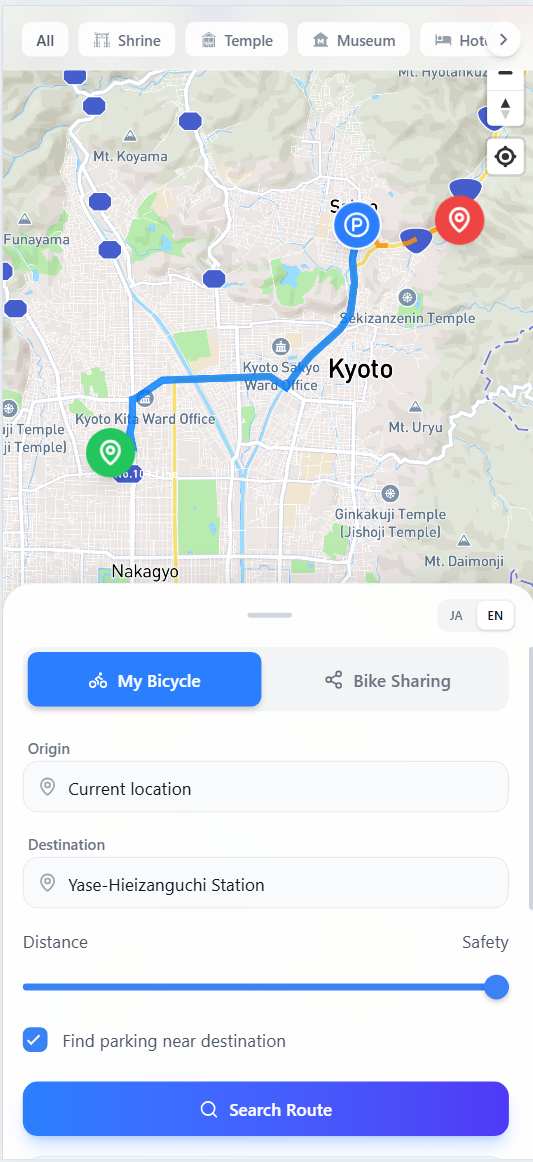
“Safe Pedal” is a cycling navigation app designed for safe travel in Kyoto. It uses the National Police Agency's traffic regulation database to prioritize routes suitable for bicycles. A unique slider allows users to balance "shortest distance" and "maximum safety" based on their needs. The app also integrates real-time share-cycle data (GBFS), ensuring that both residents and tourists can navigate the city safely and confidently.
Download
□web app
https://kyoto-cycling-web.vercel.app/
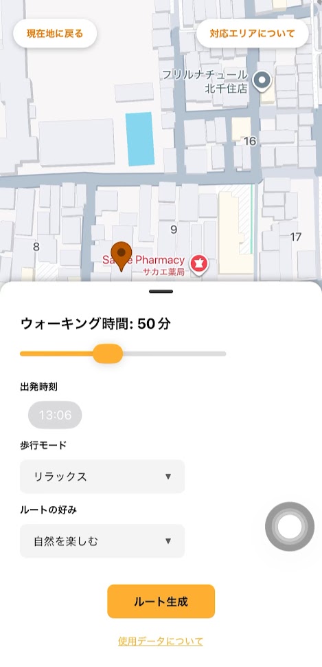
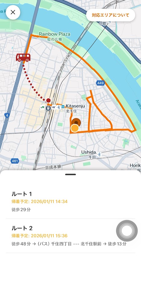
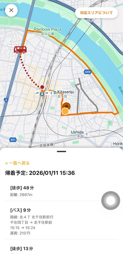
Waaalk is a mobile app that encourages community exploration by integrating public transit into walking routes. It proposes loop itineraries where users walk far from home and take a bus or train back to a nearby station. Using multiple open data sources, the app i) schedules public transit routes, ii) generates safe and accessible pedestrian paths suitable for strollers and wheelchairs, and iii) tailors routes based on environmental and urban features such as greenery or commercial activity. Waaalk transforms everyday walks into an adventure and builds a deeper connection between people and their neighborhood.
Download
□web app
https://web.waaalk.com/
□mobile app
https://apps.apple.com/gh/app/waaalk/id6756814515
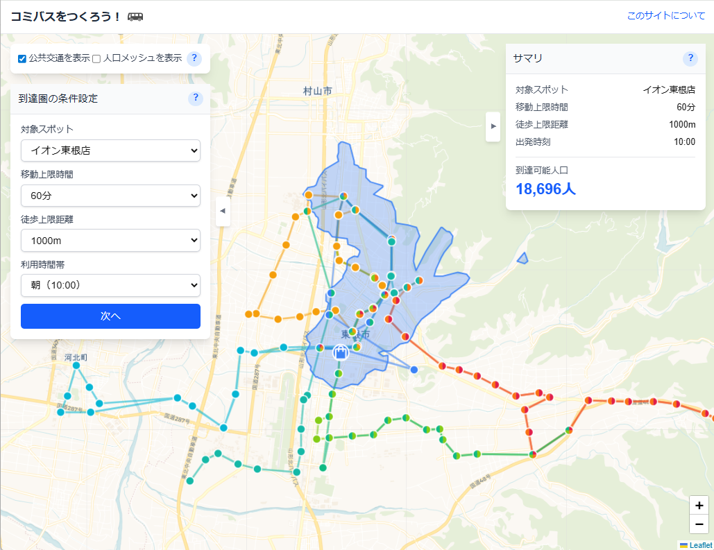
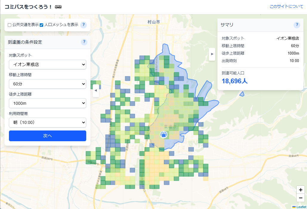
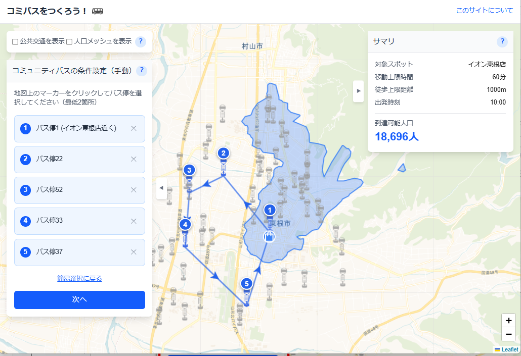
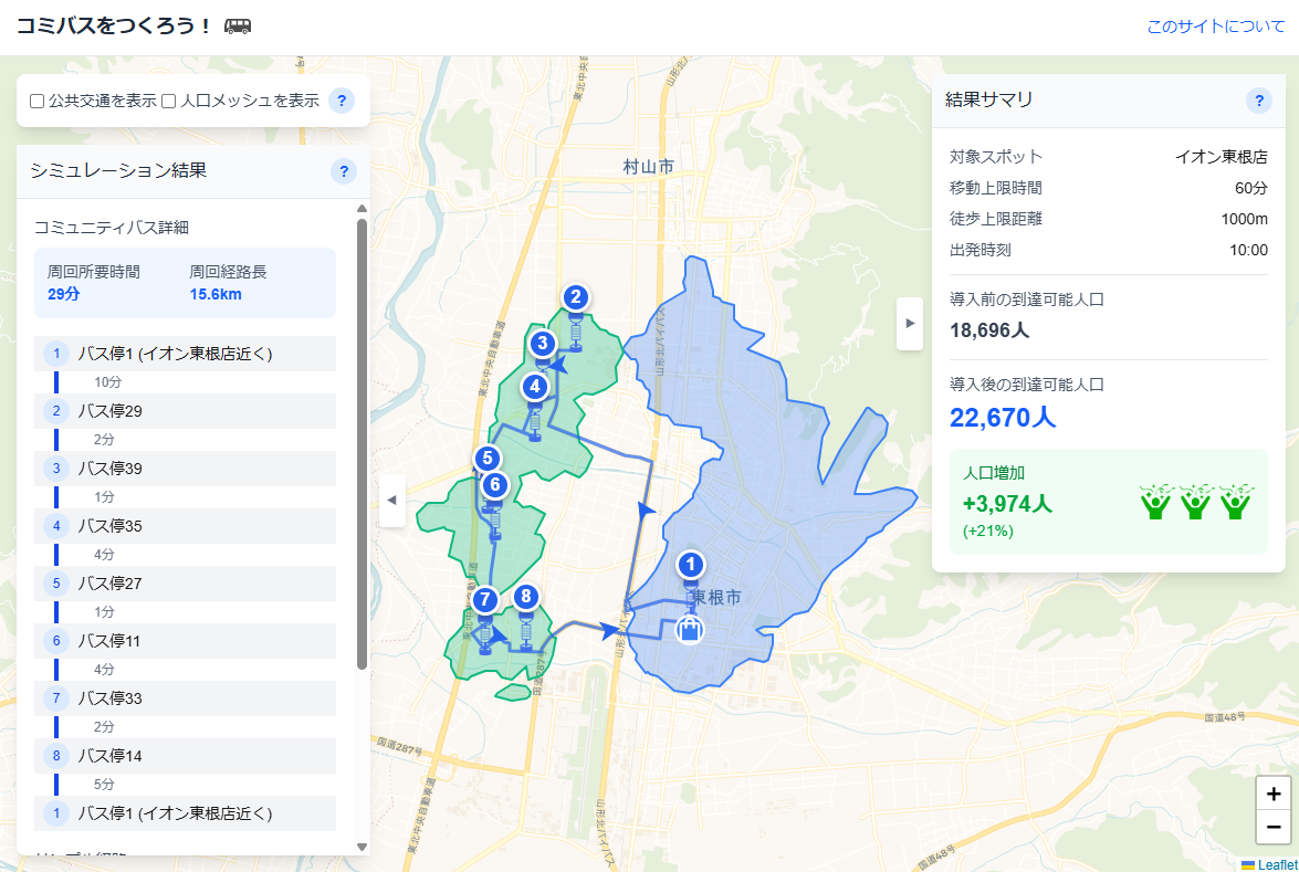
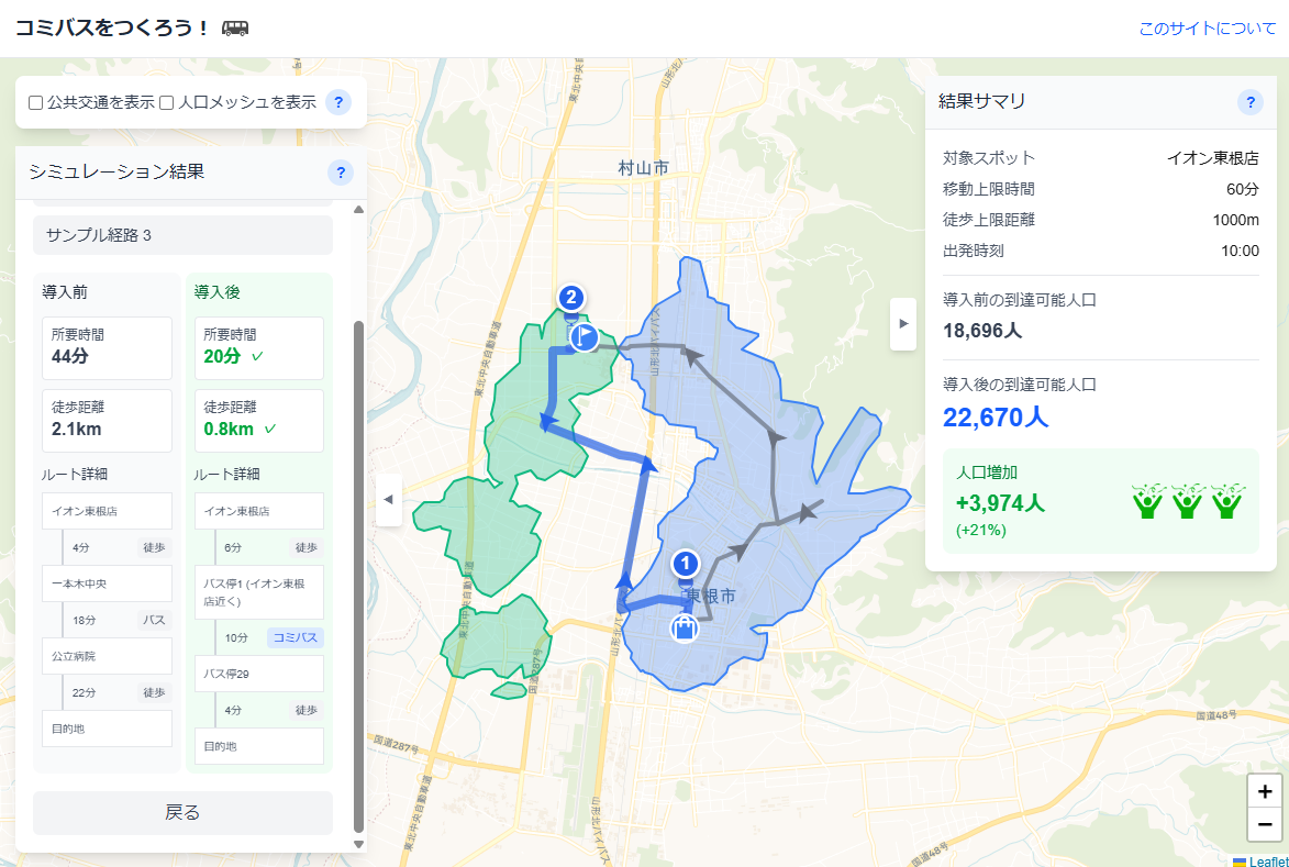
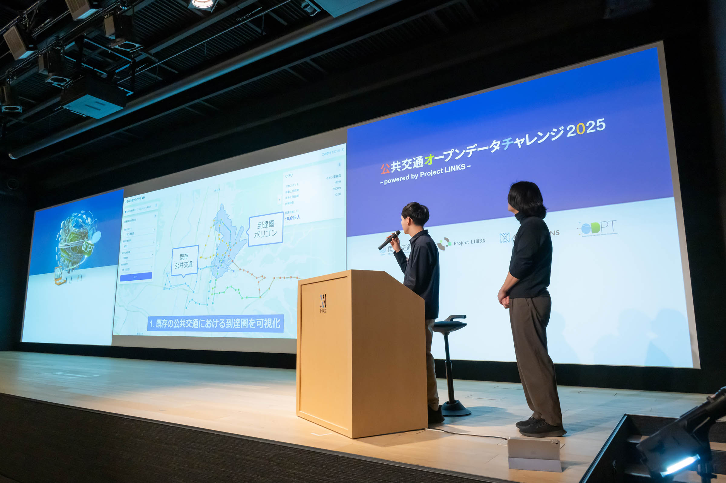
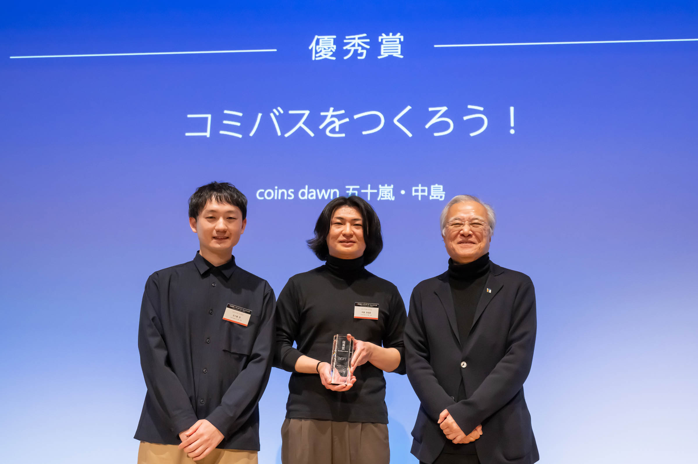
“Let’s Design a Comi-Bus!” is an intuitive web service for simulating the impact of community bus routes. Aimed at municipal planners, it allows users to easily generate routes by selecting stops on a map. The tool calculates and scores regional accessibility by combining new routes with existing transit data. This enables officials to measure the effectiveness of their policies beforehand, ensuring better transportation solutions for transit-depleted areas.
Download
□web app
https://shikan.vercel.app/
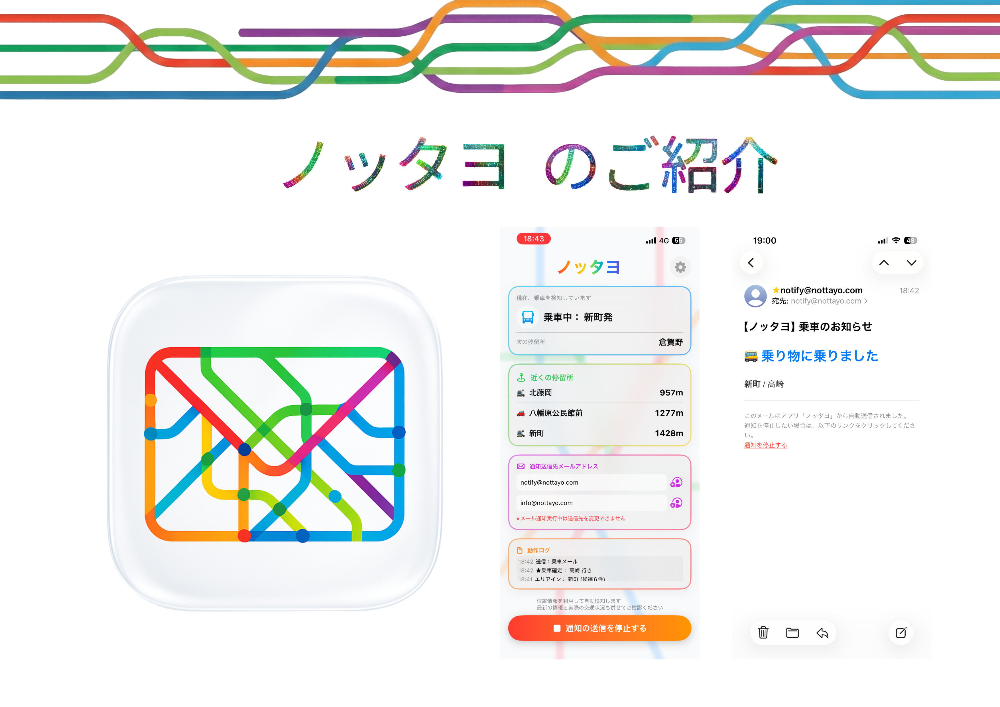
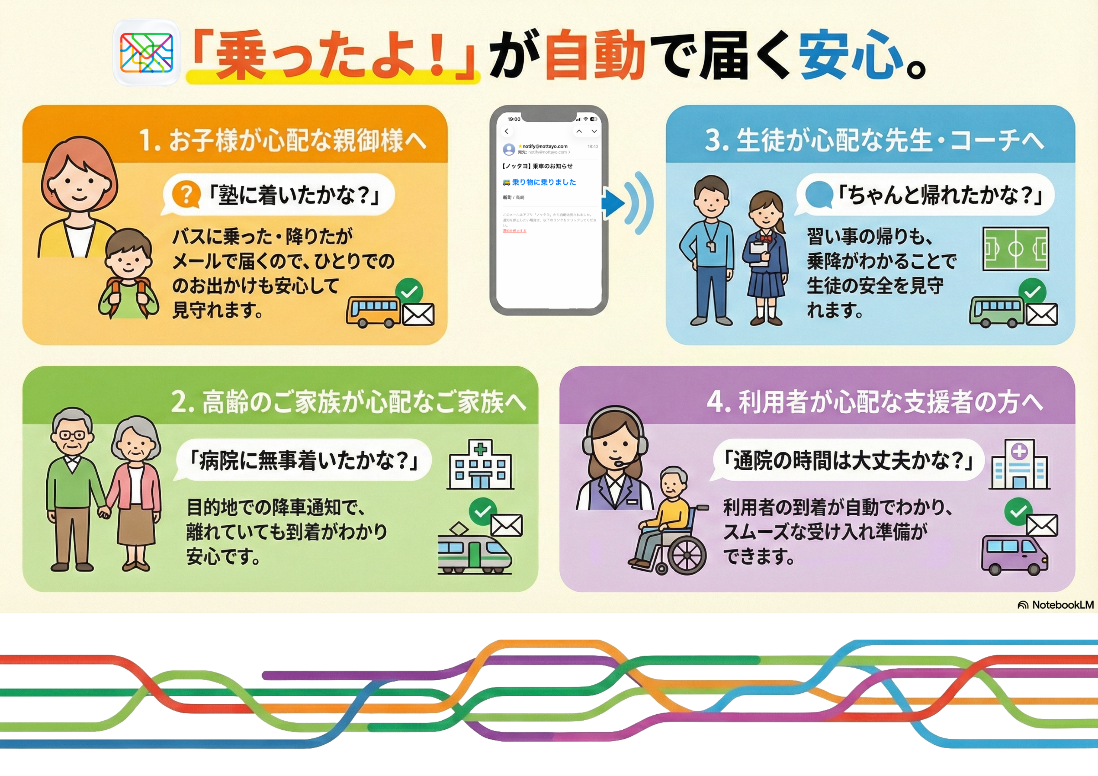
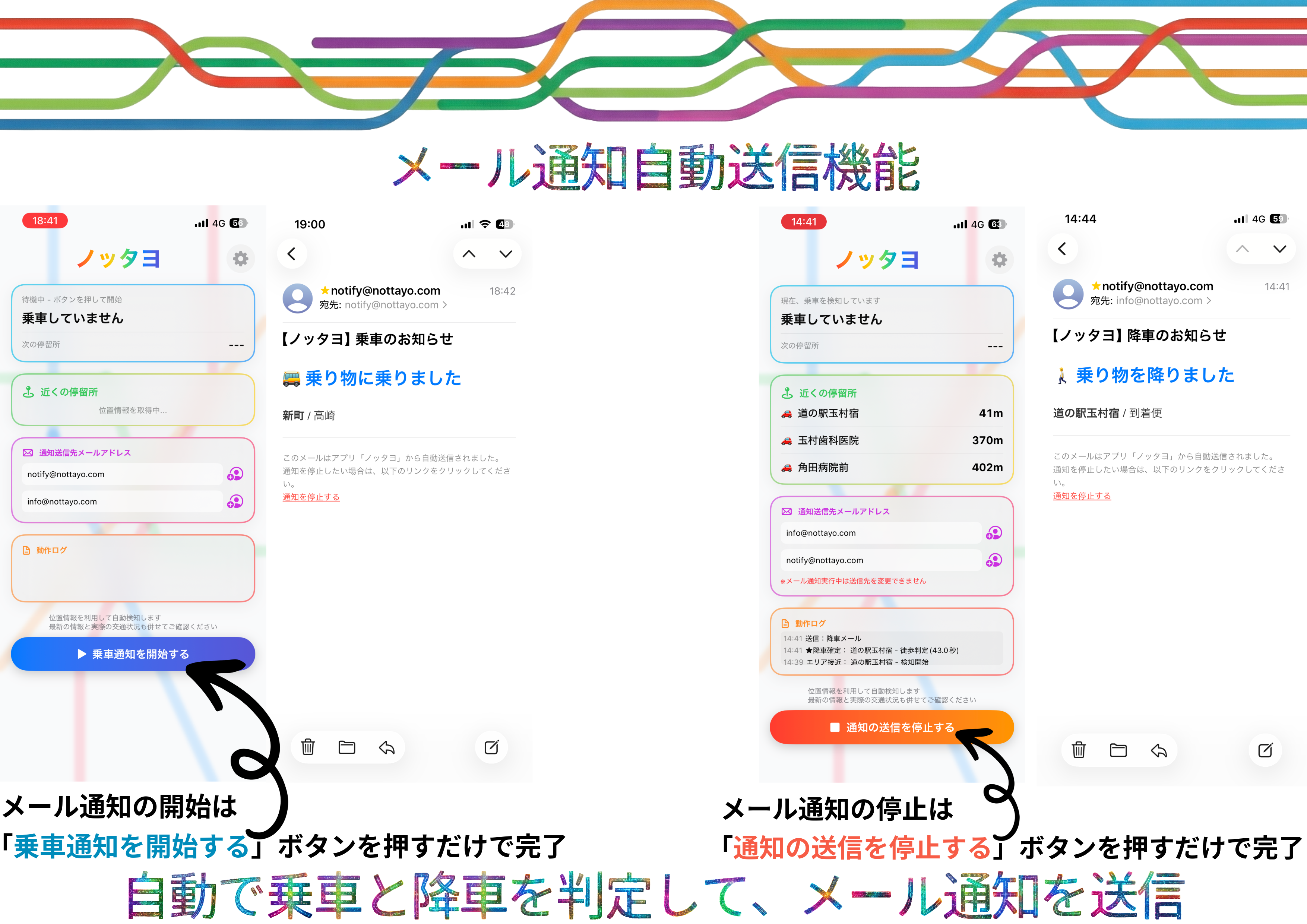
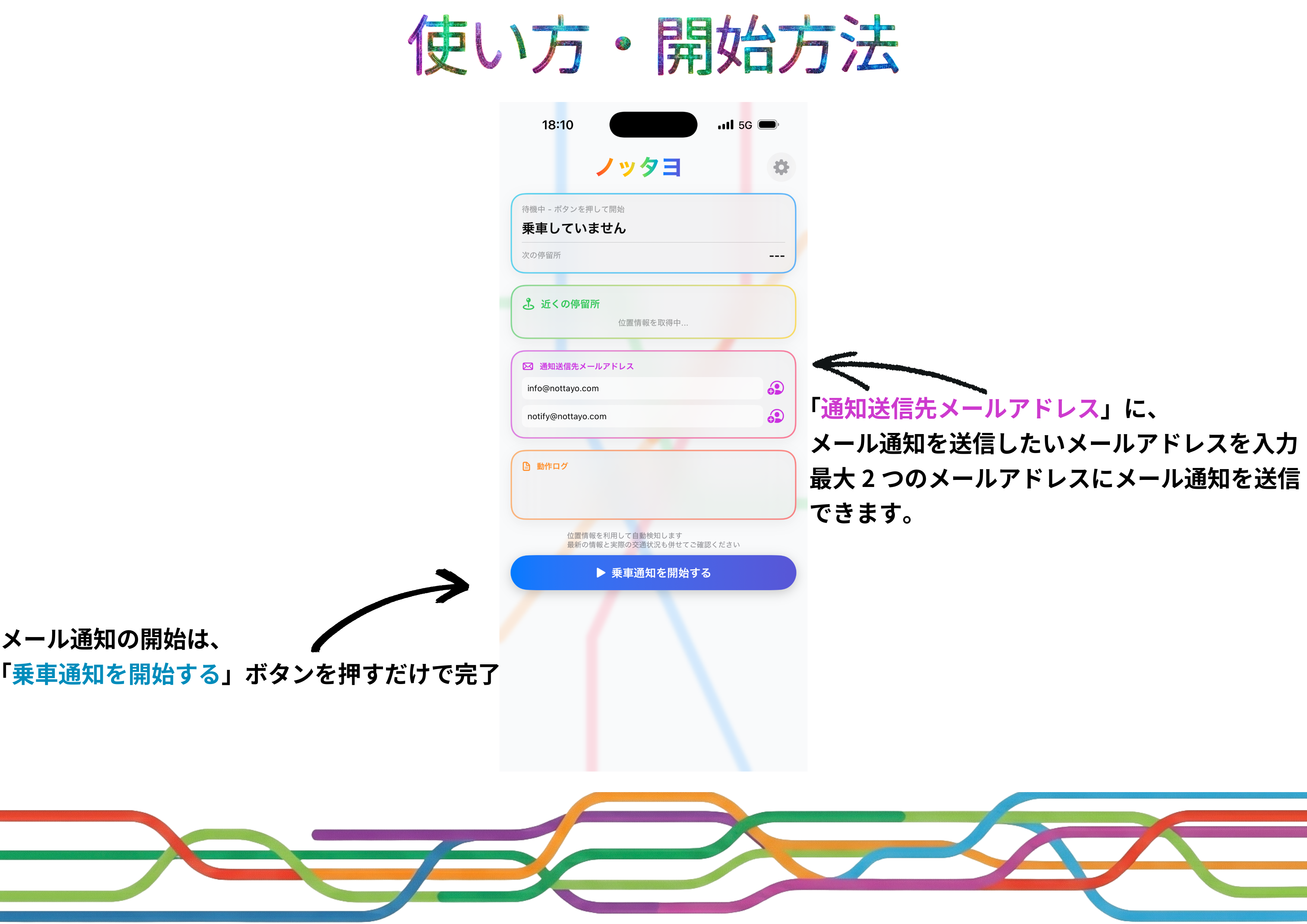
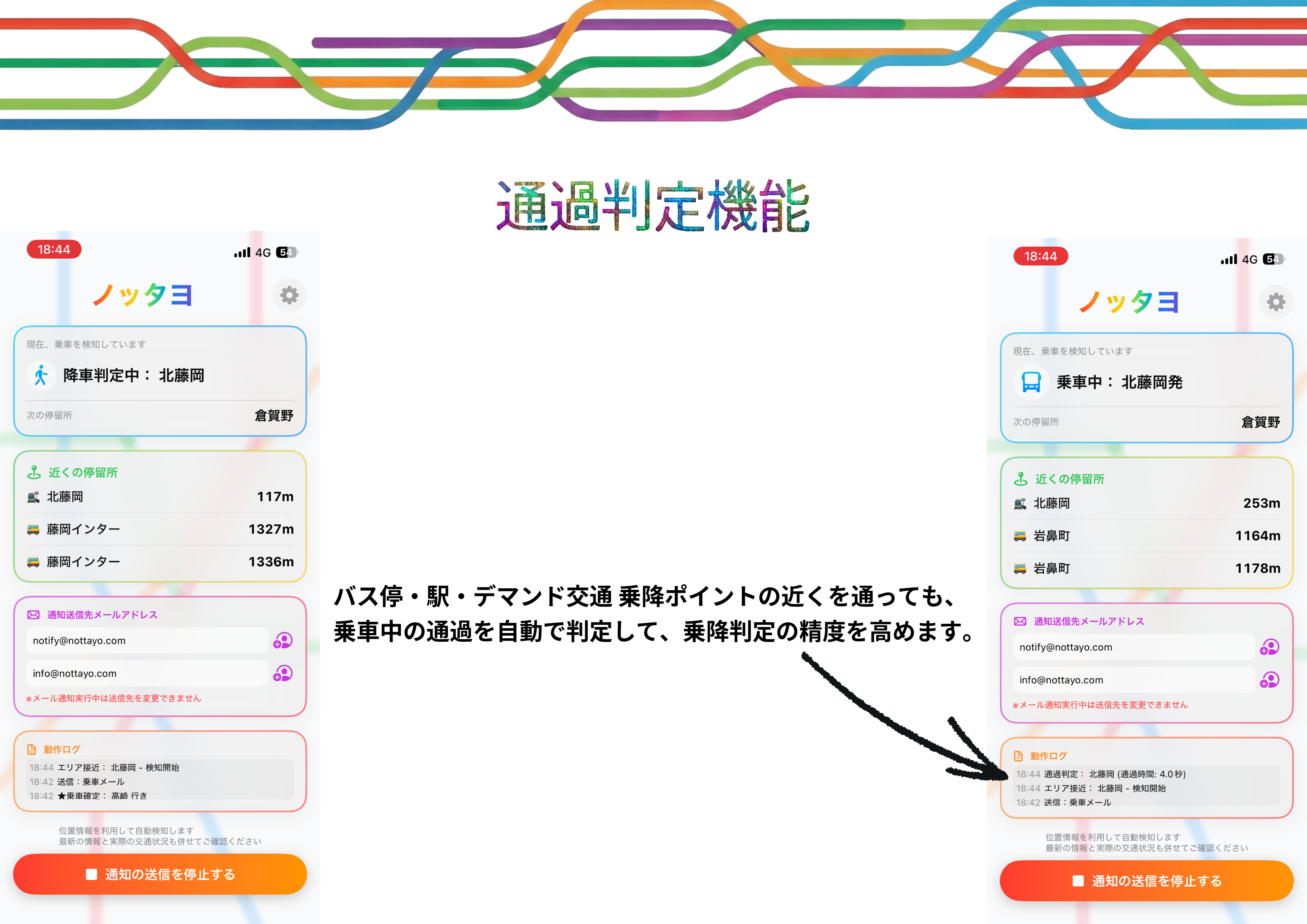
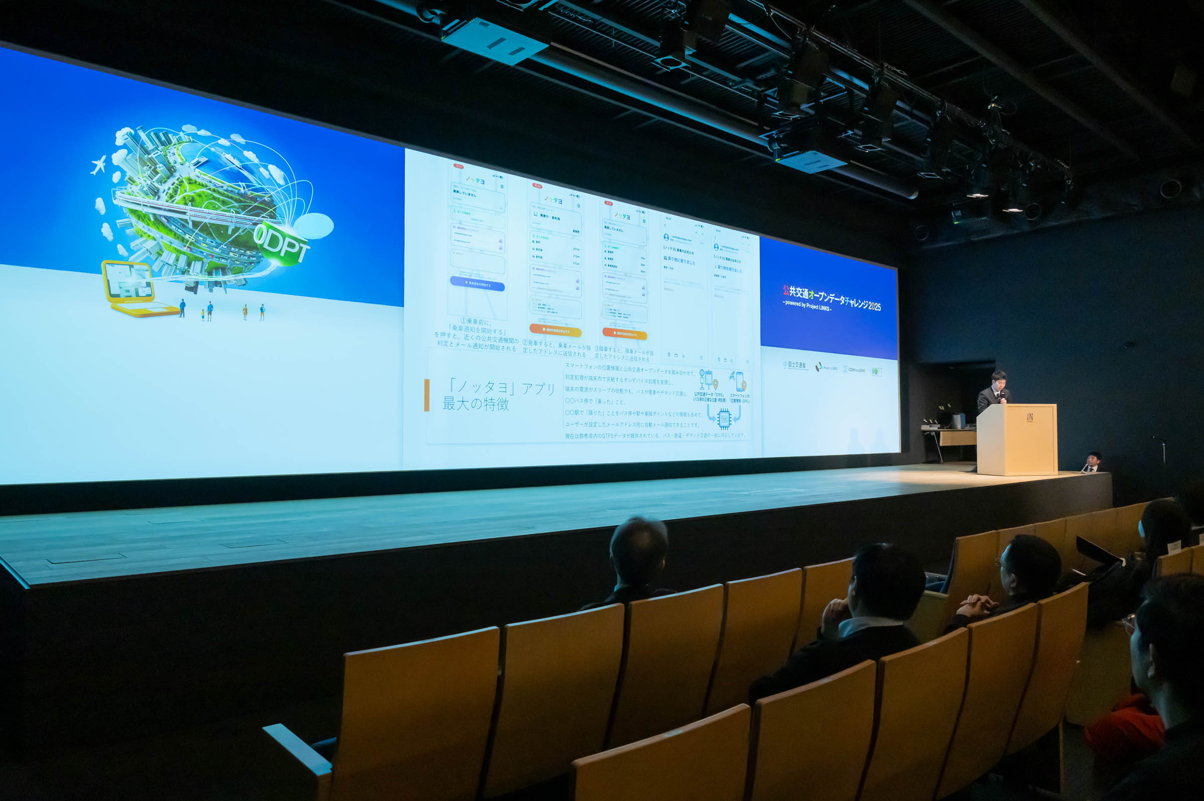
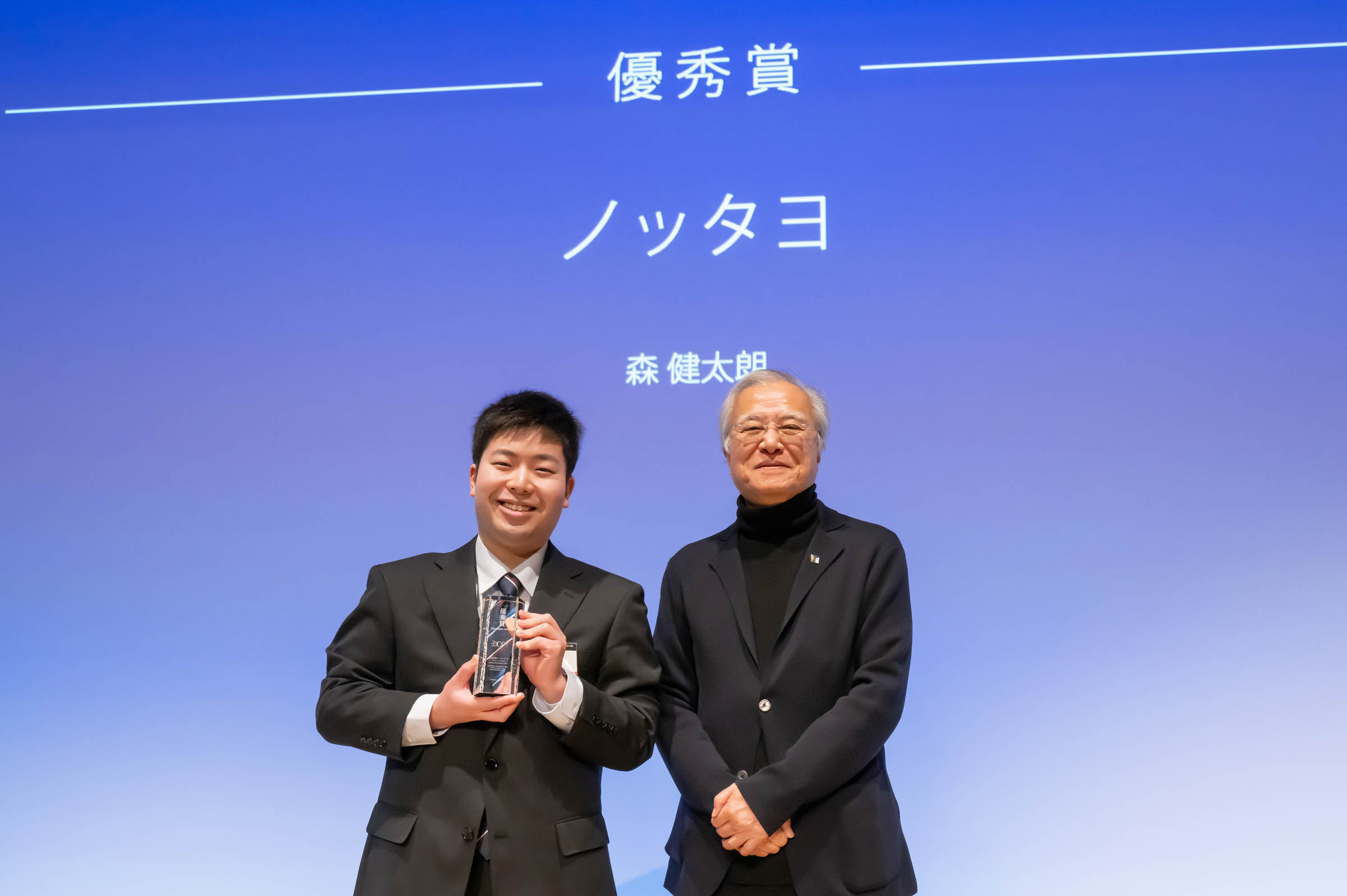
Nottayo is an app that automatically detects when you board and exit public transportation—even on buses, trains, and on-demand services without special equipment—by combining your smartphone's location data with public transit schedules. It then sends automatic email notifications.
Using proprietary logic, it comprehensively analyzes GTFS data (latitude/longitude) and timetable information to determine boarding and alighting points, specifying where you boarded and alighted, and notifies you via email.
On-device processing ensures continuous operation even in areas with unstable signal reception while protecting your privacy.
Email notifications can be sent automatically even when your smartphone is in sleep mode.
Download
□iOS app
https://apps.apple.com/jp/app/%E3%83%8E%E3%83%83%E3%82%BF%E3%83%A8/id6757594627
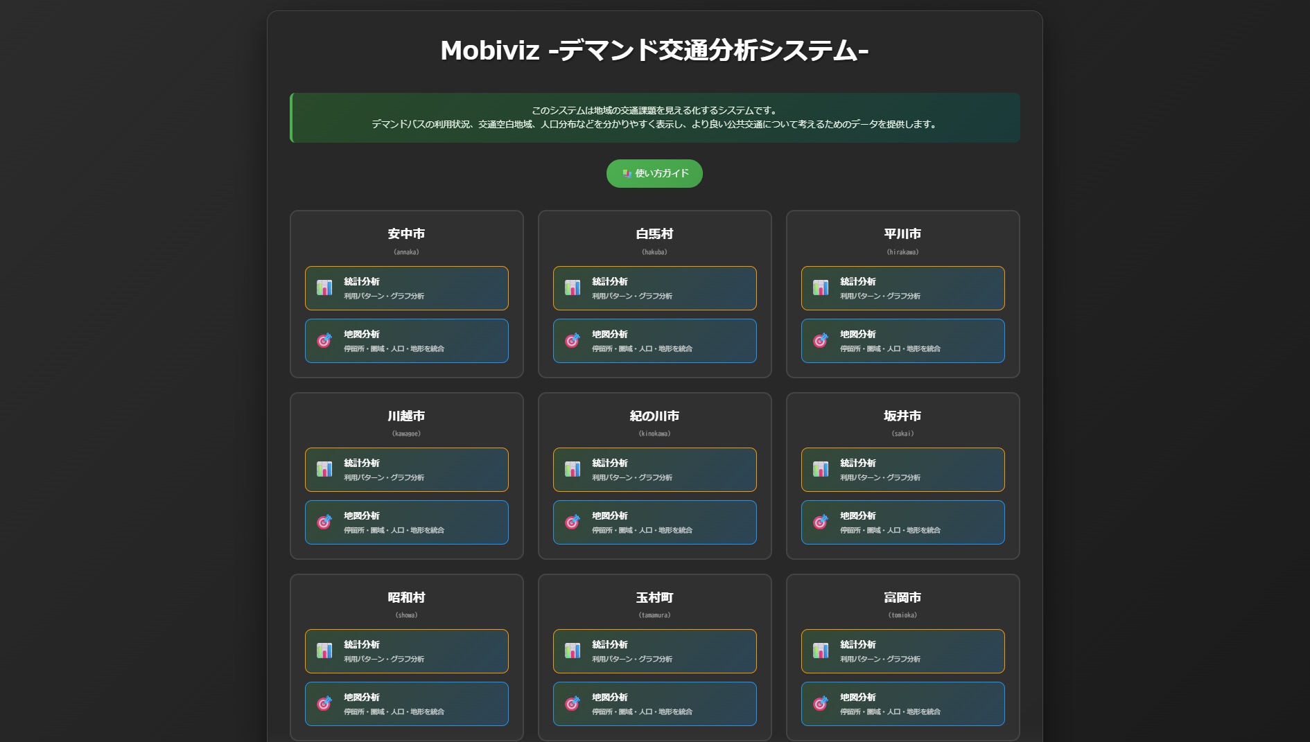
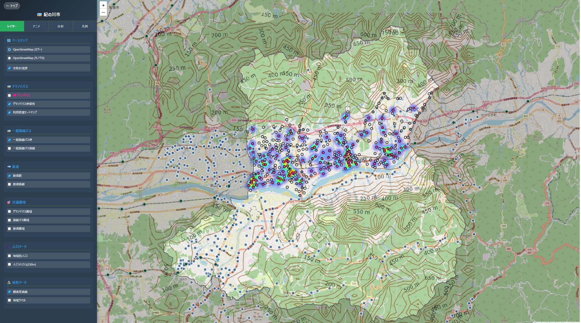
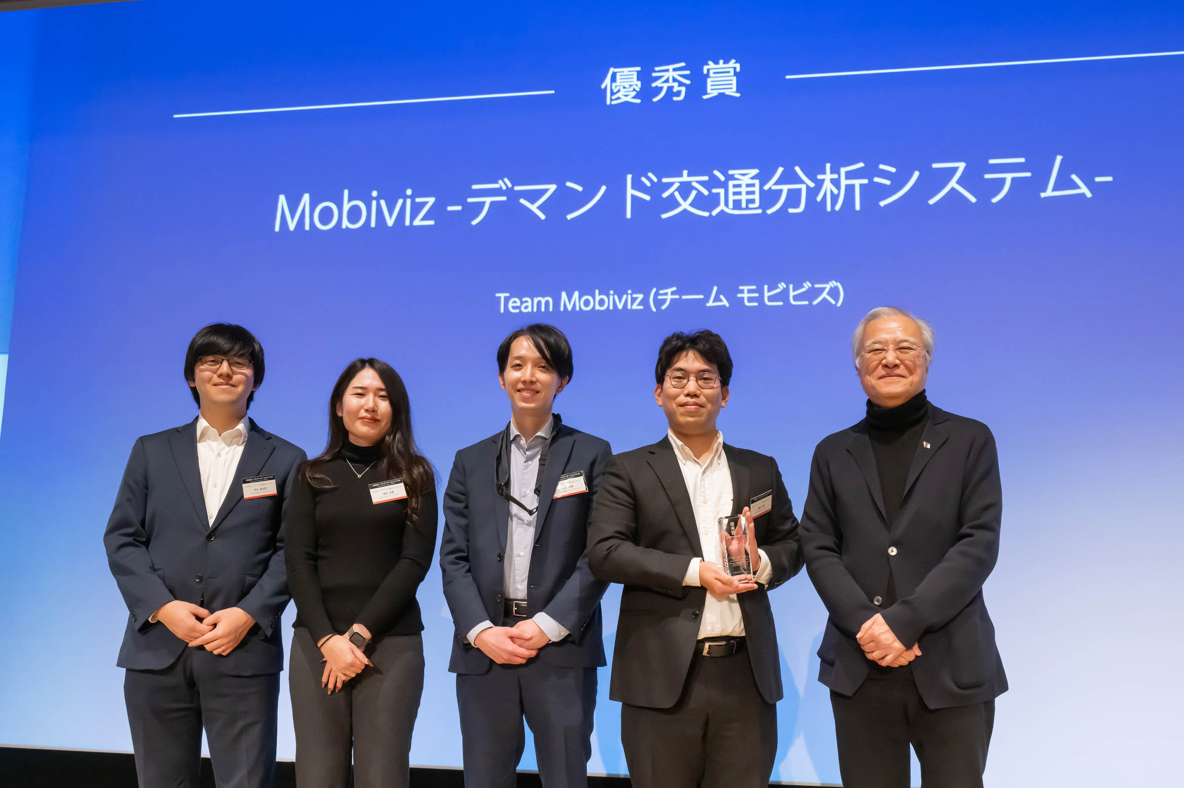
“Mobiviz: Demand-Responsive Transit Analysis System“ is a comprehensive analysis tool designed to support local governments in enhancing the efficiency and operation of demand-responsive transit (on-demand buses). By leveraging GTFS data and passenger records, the system visualizes and analyzes traffic conditions through an intuitive, web-based interface. It combines interactive map-based analysis with statistical insights to provide actionable recommendations for service improvements.
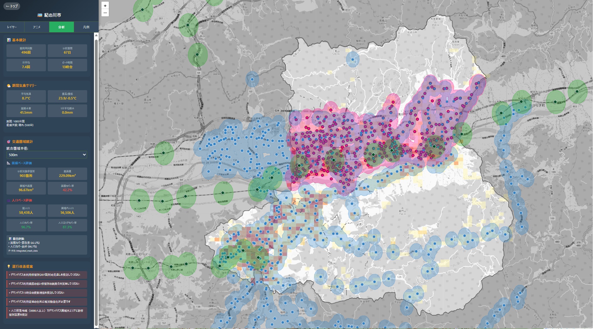
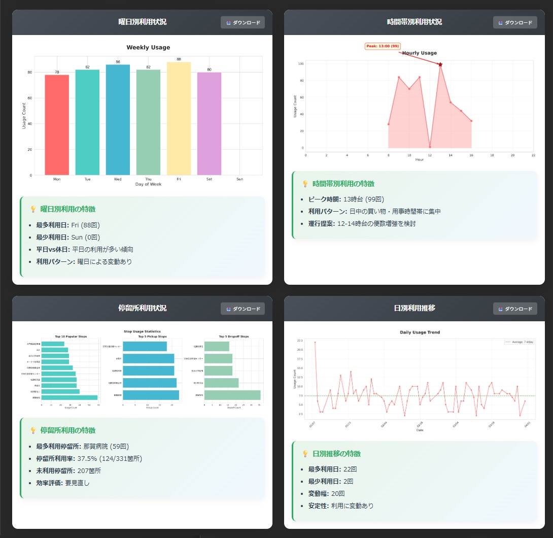
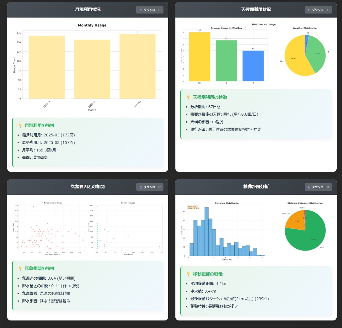
Download
□web app
https://www.mobiviz.net/
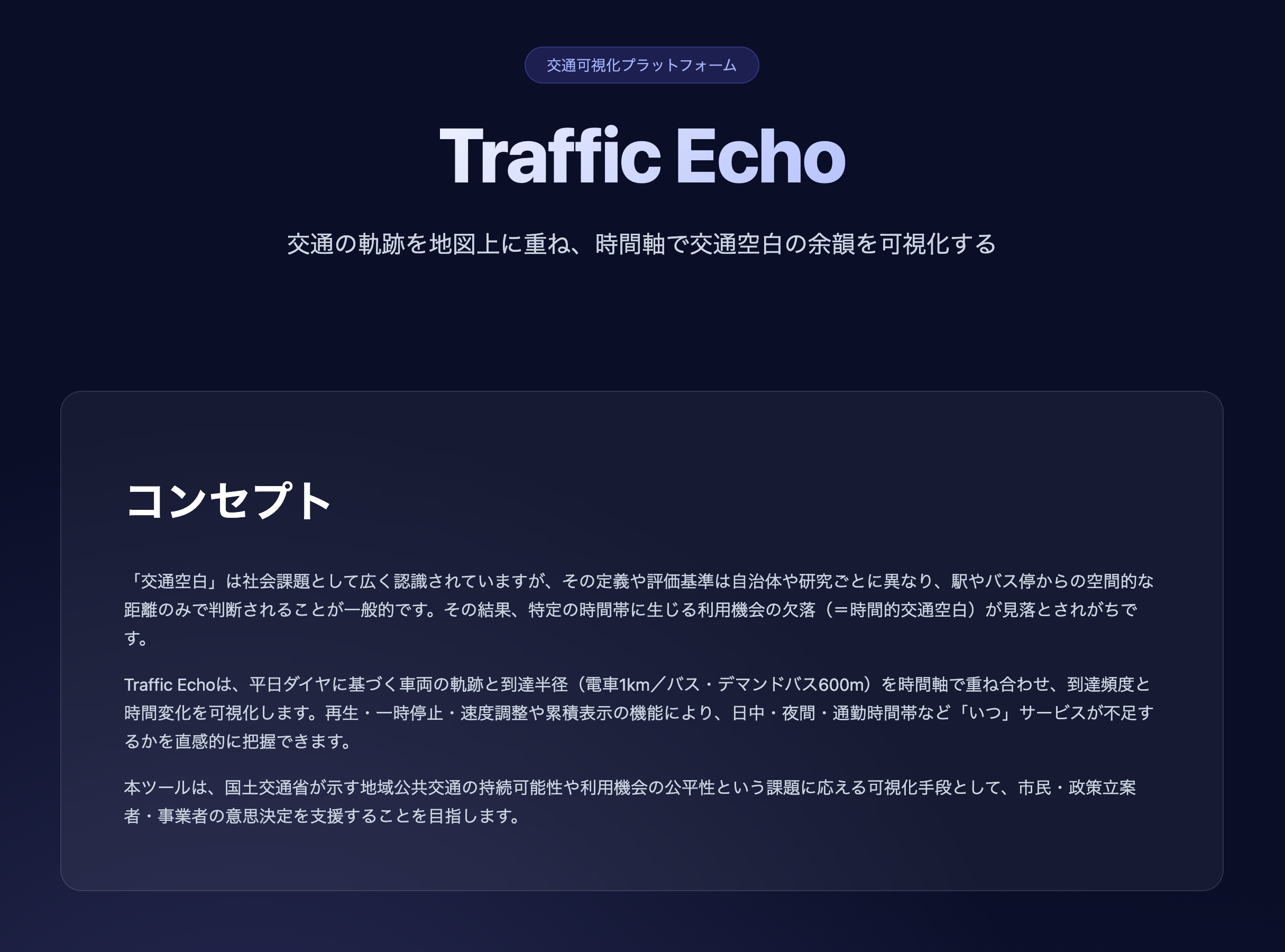
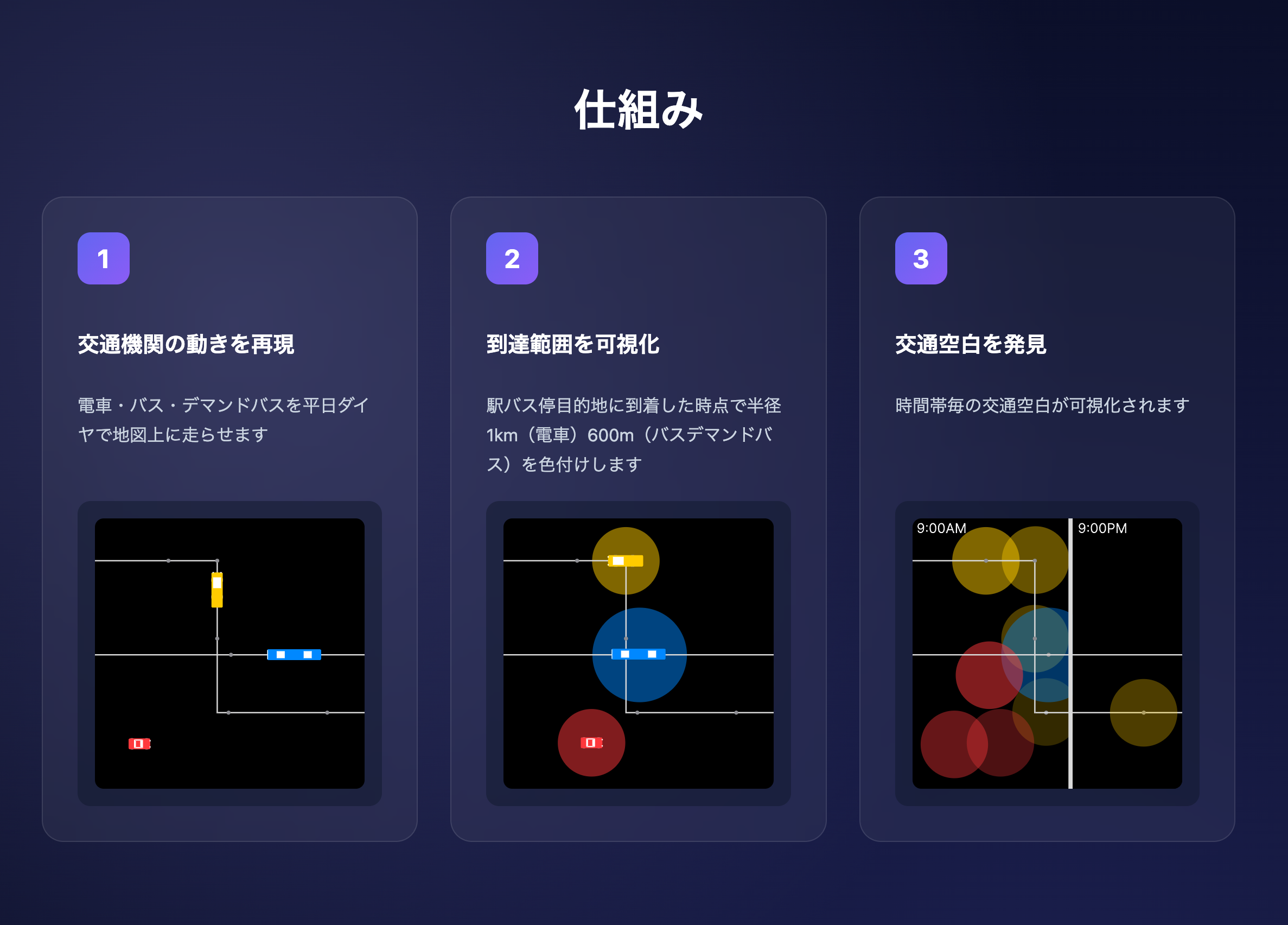
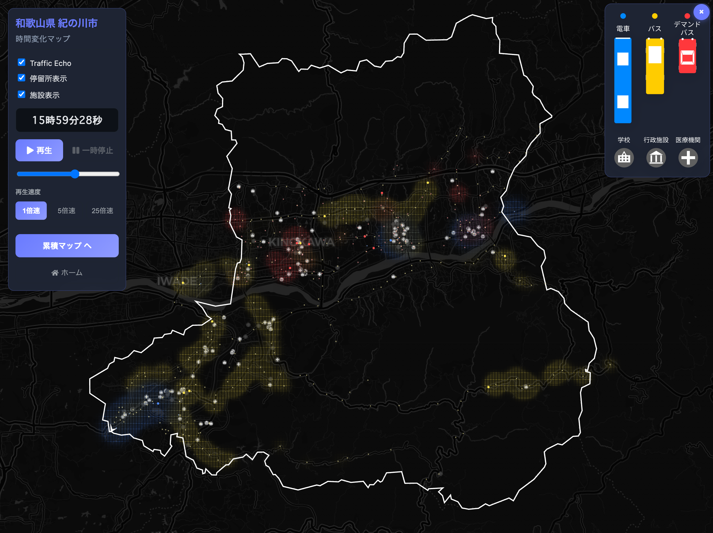
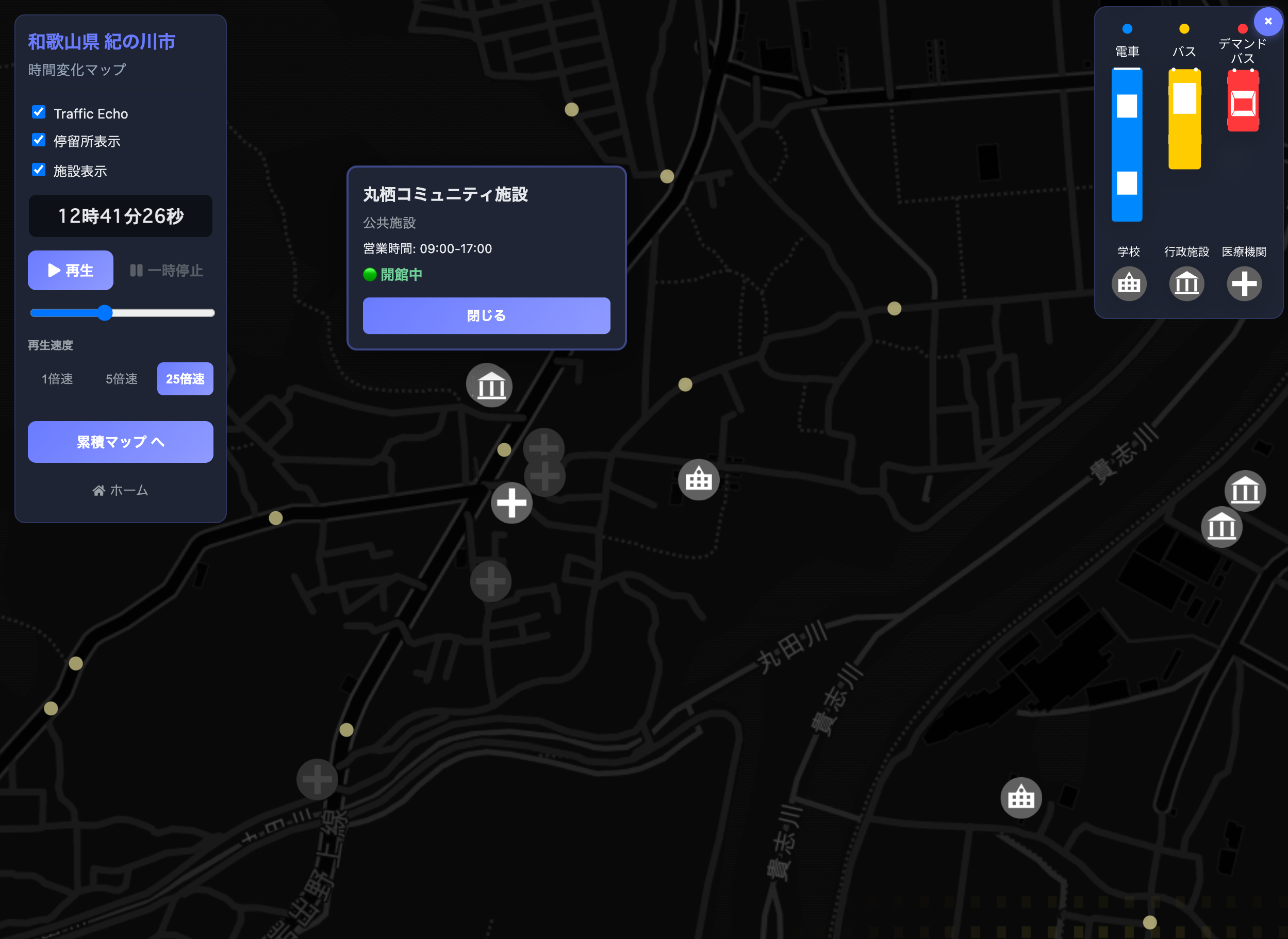
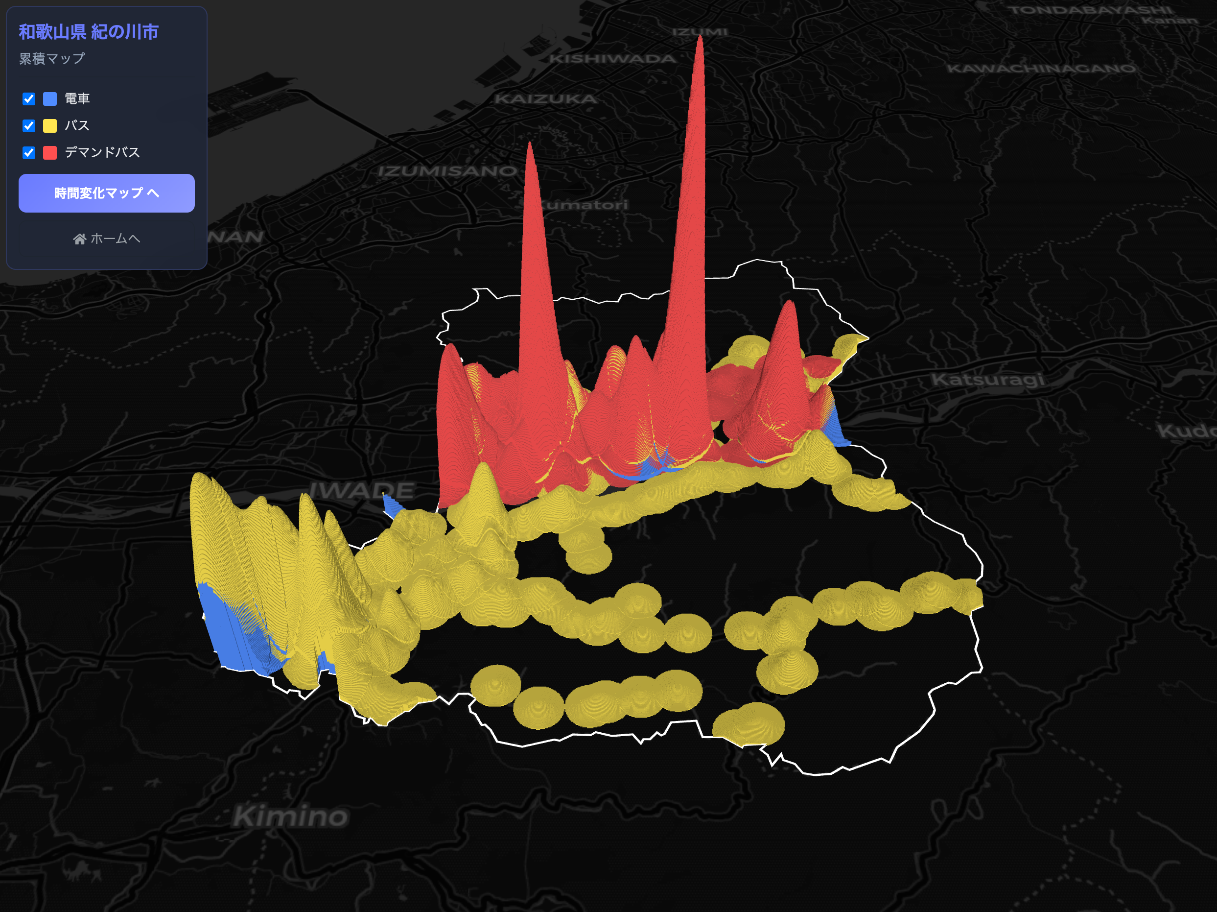
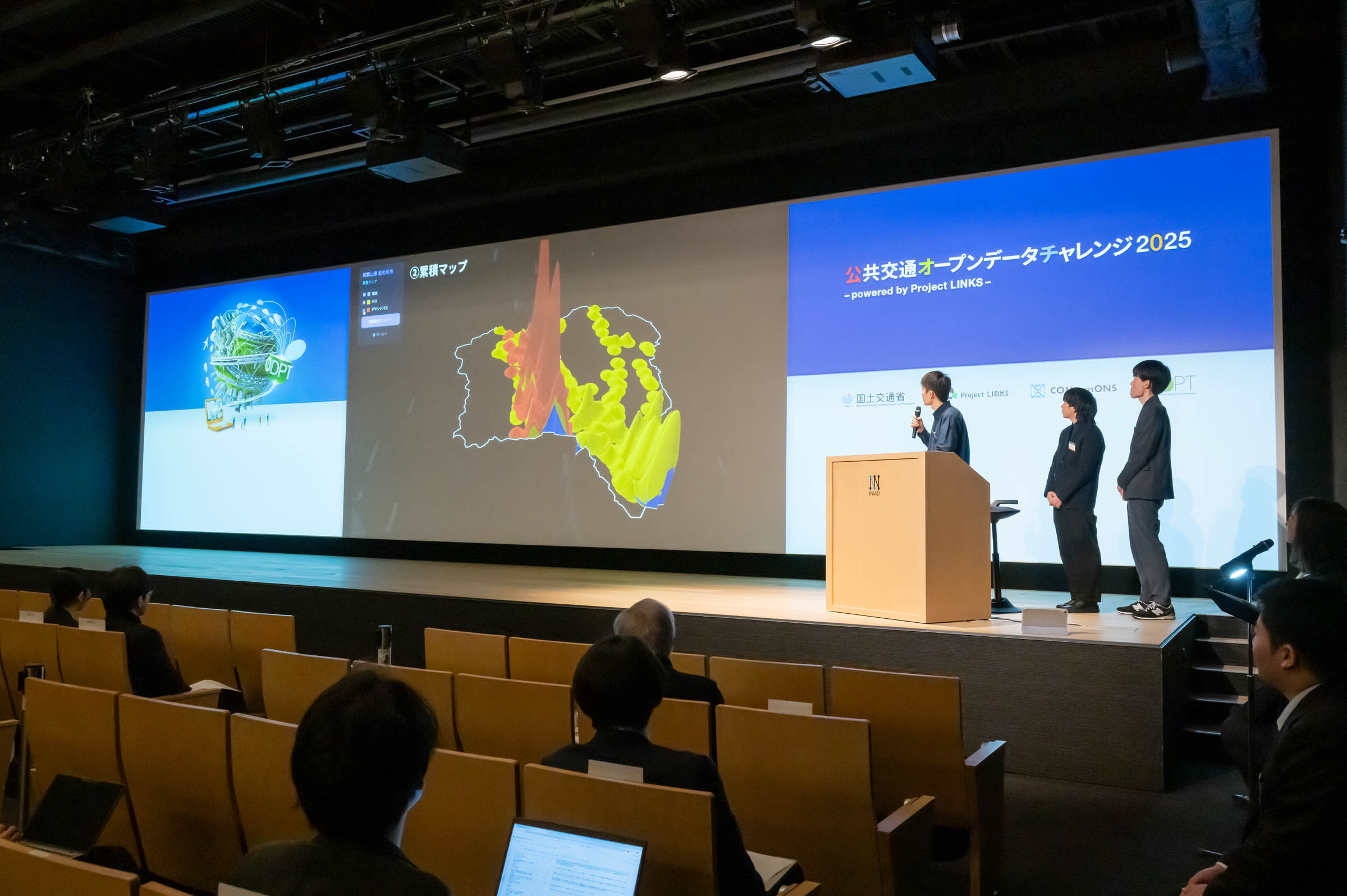
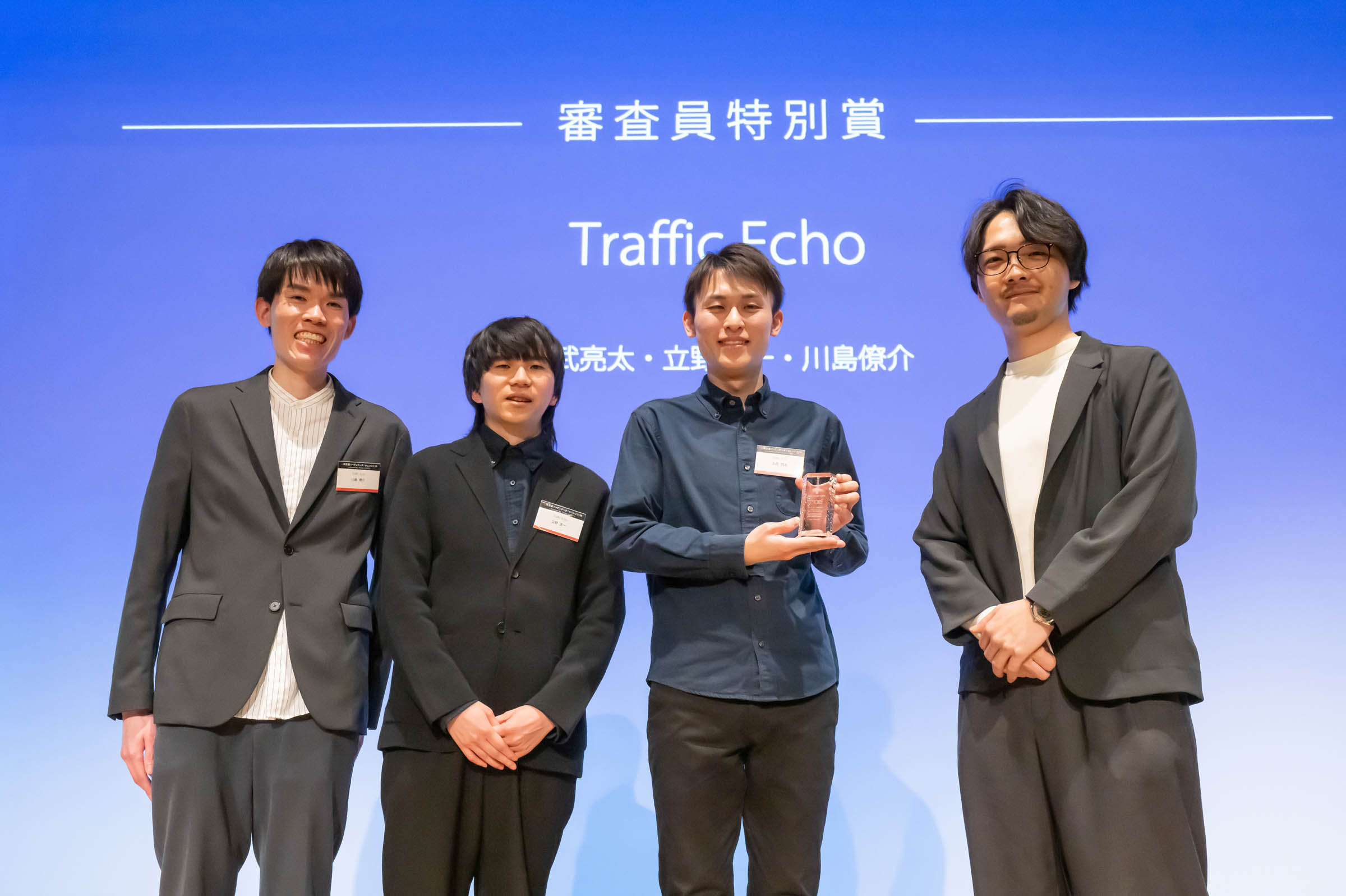
Traffic Echo reimagines transit accessibility as a dynamic phenomenon rather than a static map. By visualizing the "echo"—the lingering convenience that fades after a vehicle arrives—it integrates temporal factors like service frequency into traditional spatial analysis. This approach clearly distinguishes between temporary service gaps in urban areas and persistent transit deserts in rural regions. Traffic Echo empowers local governments with data-driven insights for effective policy-making and regional revitalization.
Download
□web app
https://trafficecho.main.jp/
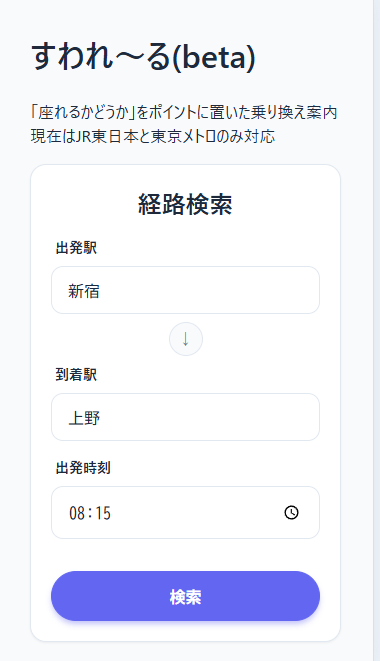
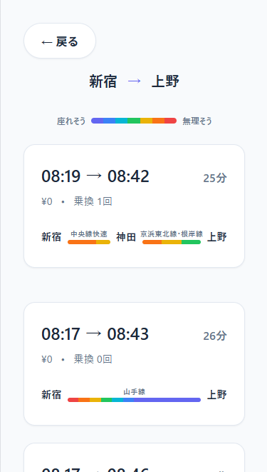
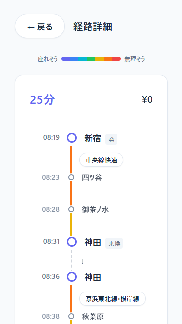
“Suwa-Rail” is a transit navigation app that displays the probability of securing a seat alongside suggested route. In major metropolitan areas like Tokyo, while users can easily find the fastest route, many prioritize the comfort of sitting, even at the cost of extra time or fare. By integrating official timetable data with the "Metropolitan Transportation Census" from the Ministry of Land, Infrastructure, Transport and Tourism, the app simulates passenger flows at each station to calculate seat availability. It empowers commuters to choose comfort over speed, transforming the daily travel experience.
Download
□web app
https://suwa-rail.vercel.app/

"TOKYO LAST TRAIN MAP" is a web app that visualizes last train connections from central Tokyo using a "fireworks" motif. Radiating lines from Yamanote Line stations represent outbound last trains, with concentric circles indicating time. A time slider lets users watch reachable areas shrink in real time. Unlike traditional route planners, it reveals the "shifting boundaries of the city's night," encouraging timely departures. By integrating GTFS data from multiple rail operators, the app transforms raw timetable data into dynamic digital art—capturing the rhythmic stillness that descends upon a megalopolis as night deepens.
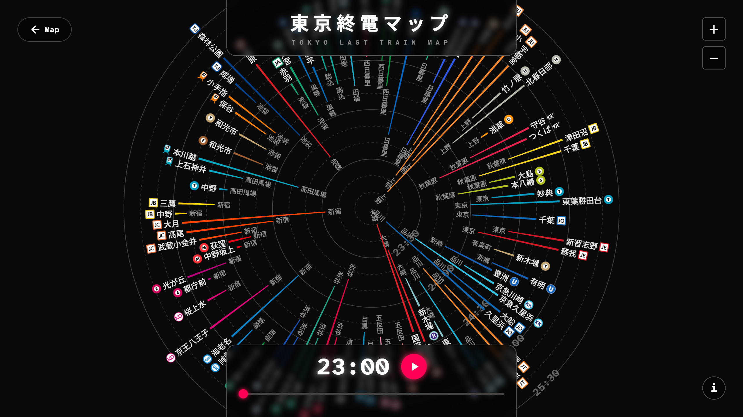
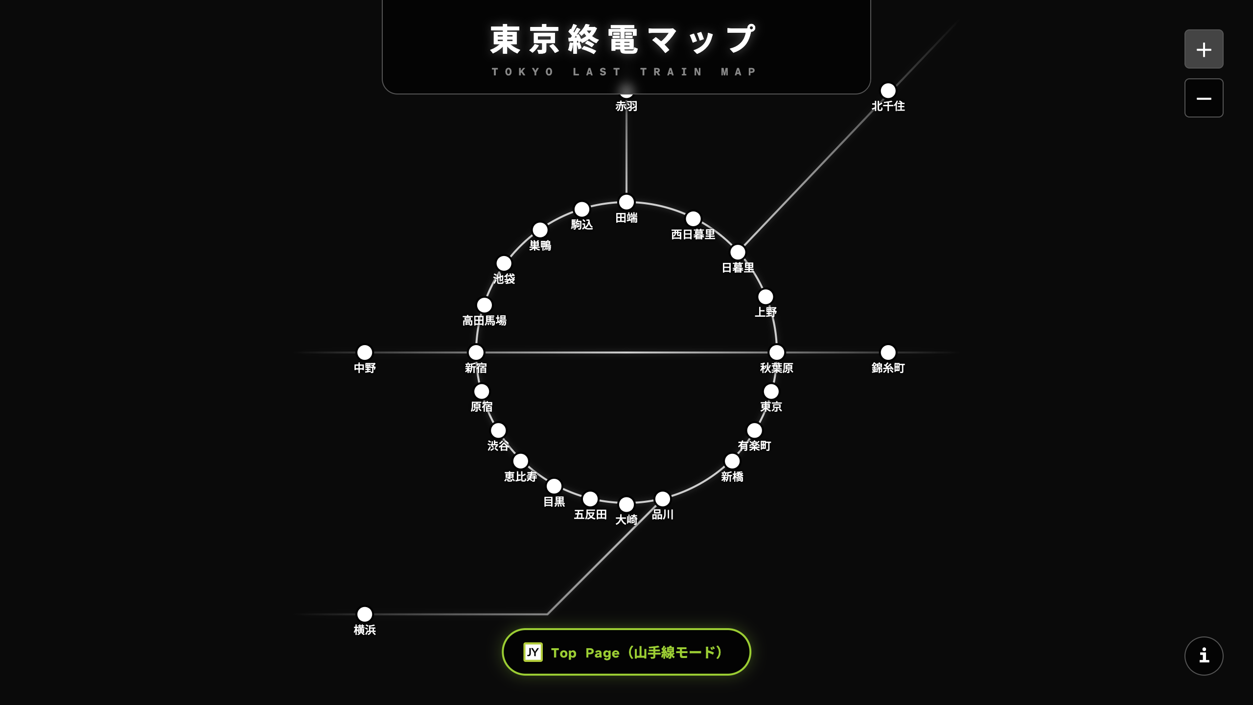
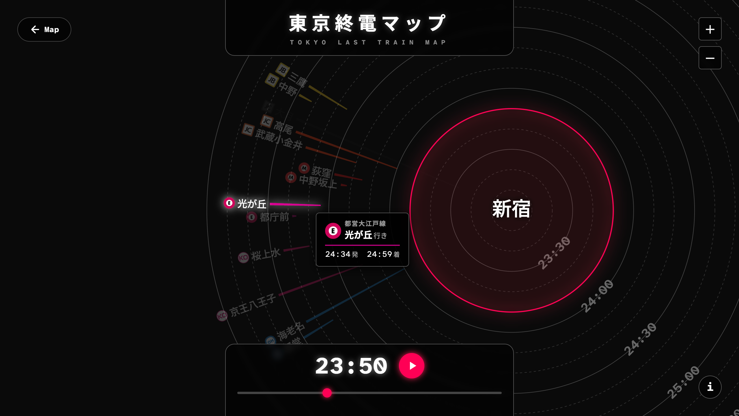
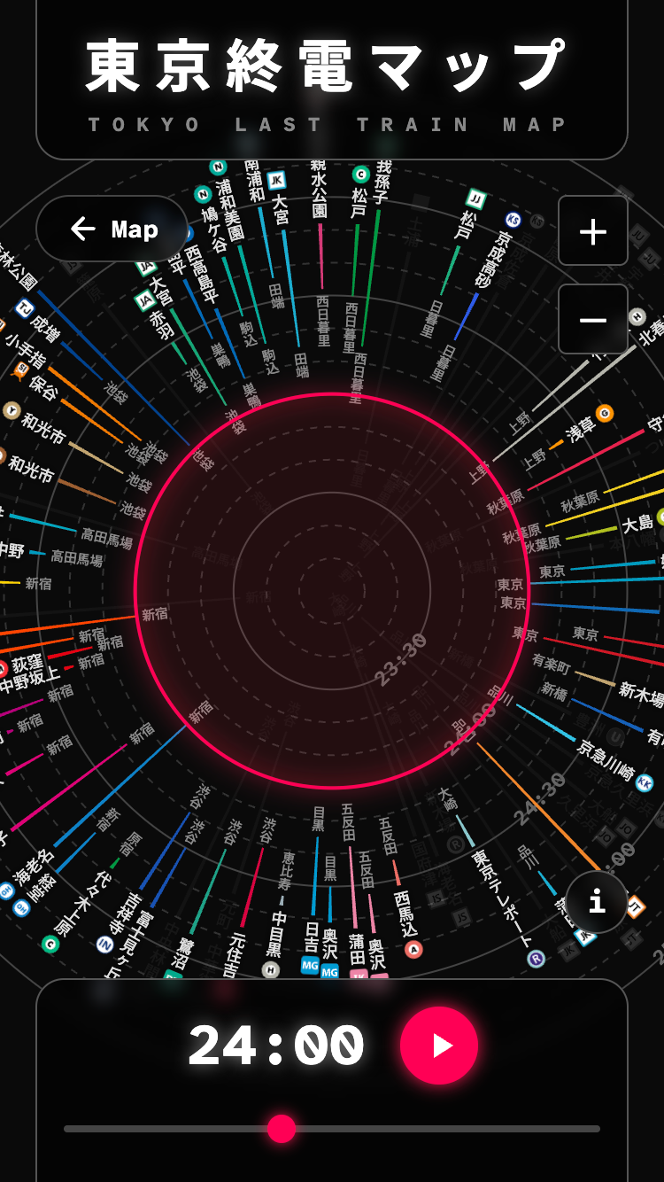
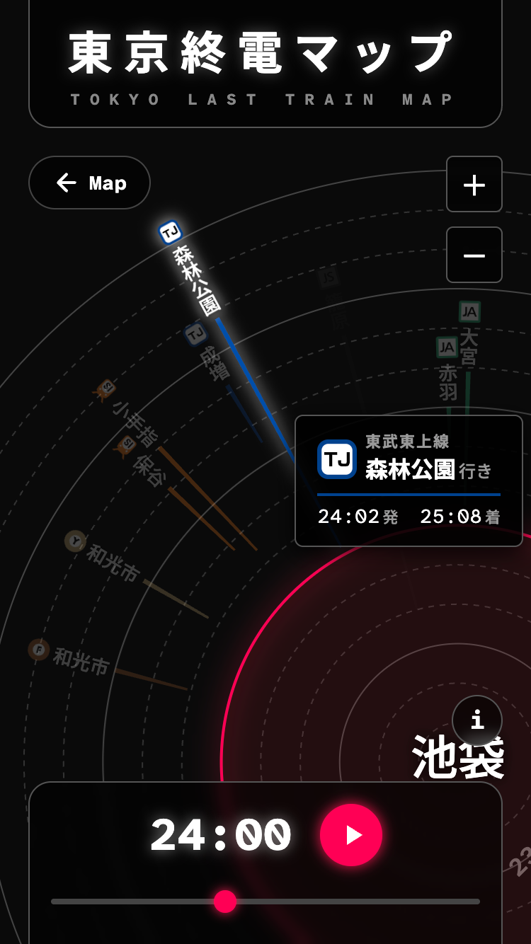
Download
□web app
https://tokyo-last-train-map.pages.dev/
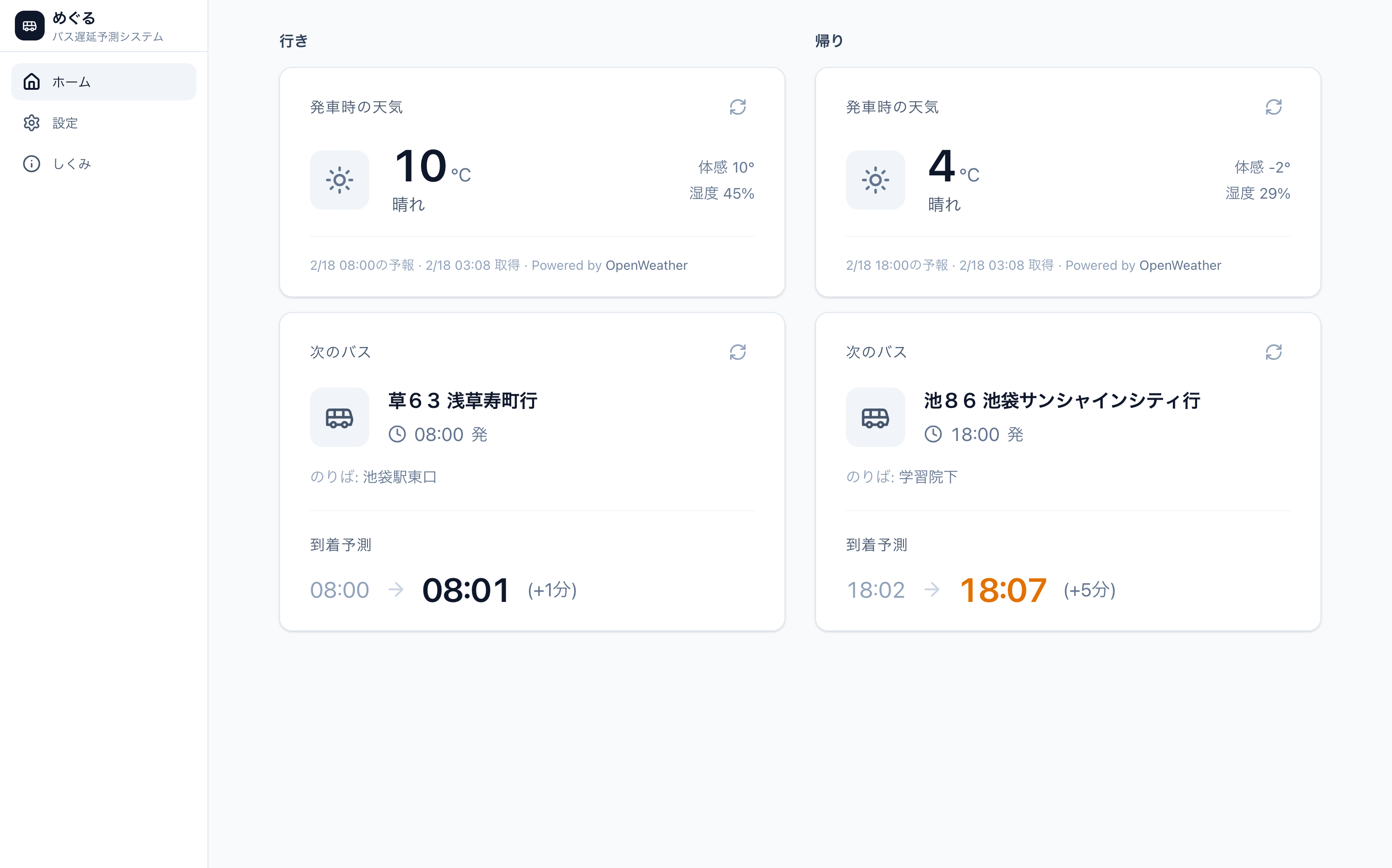
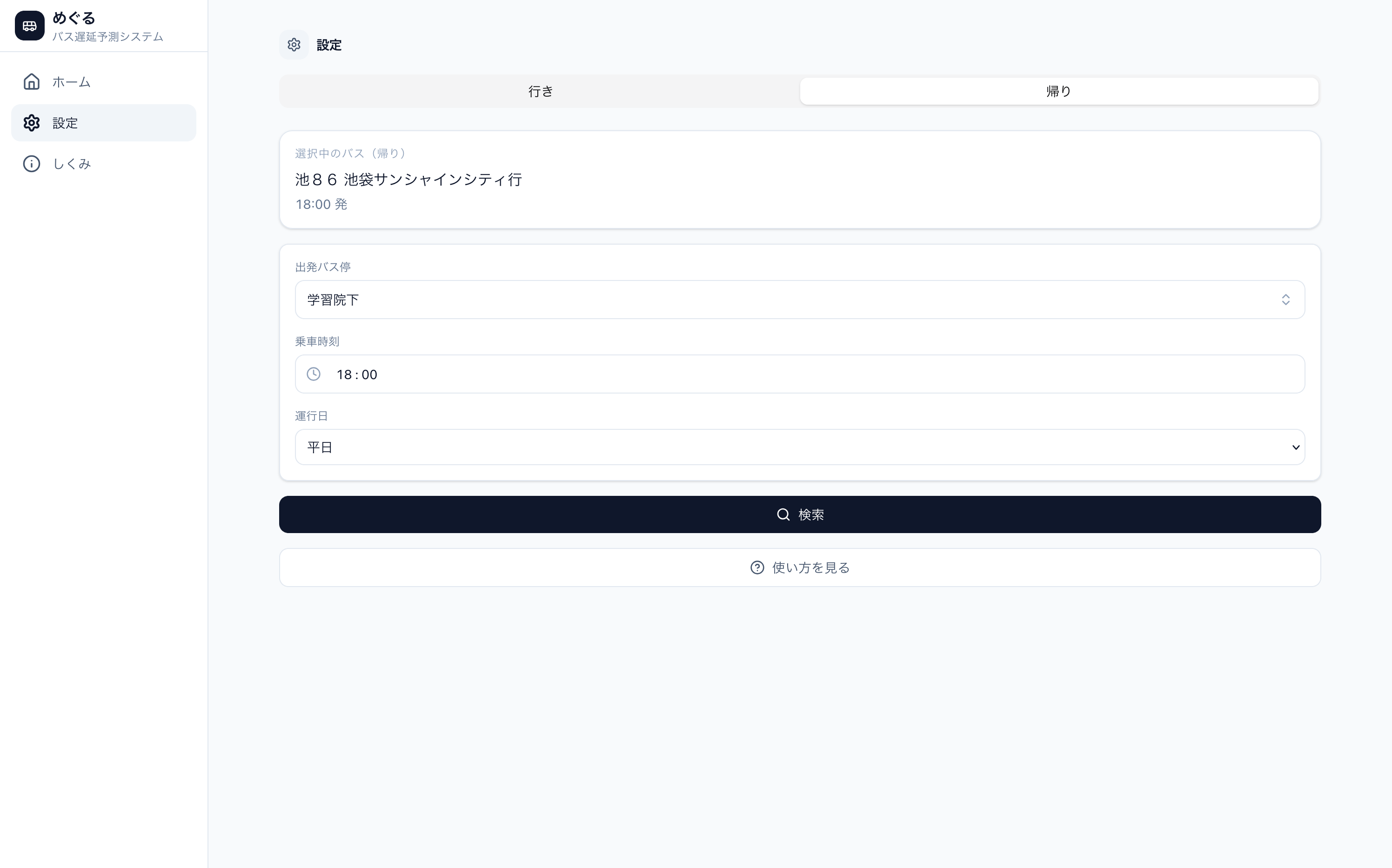
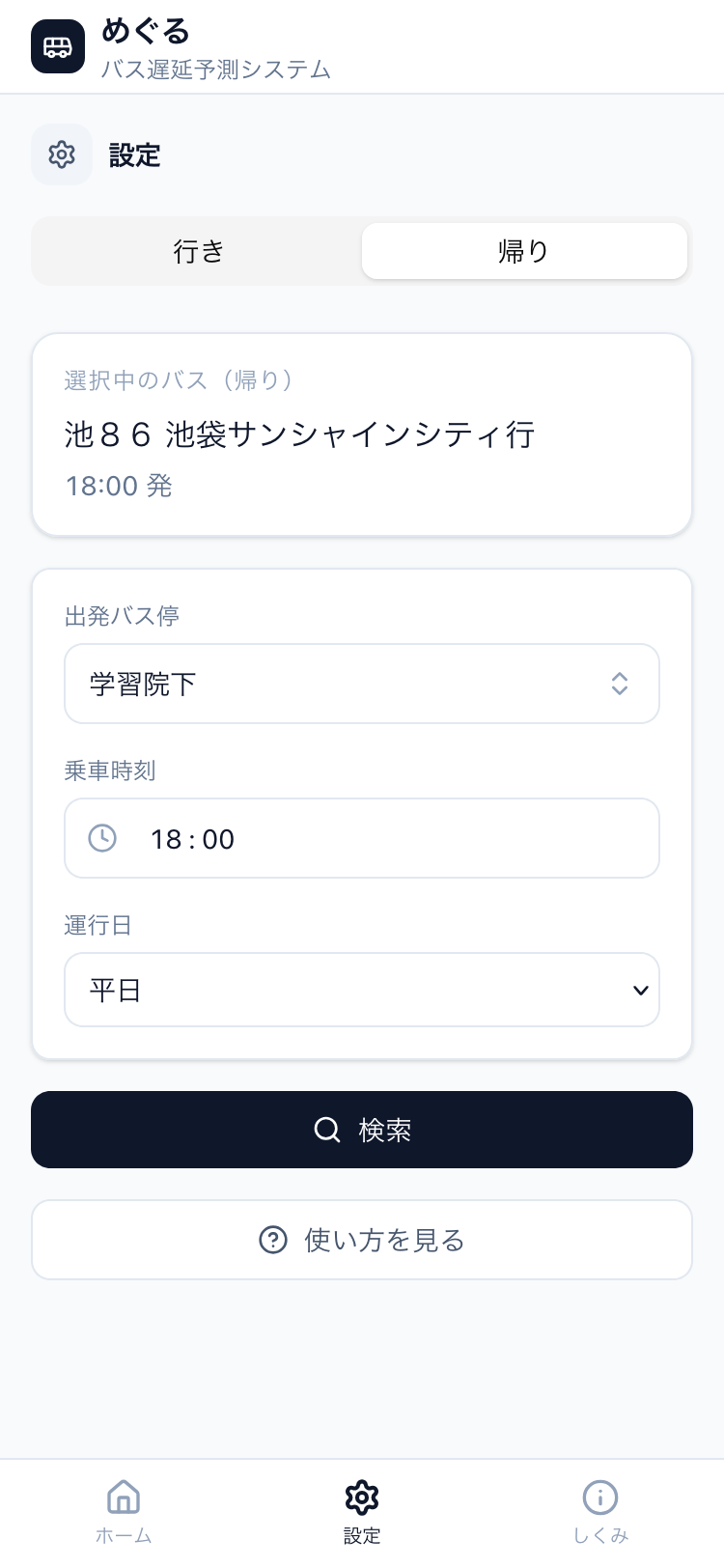
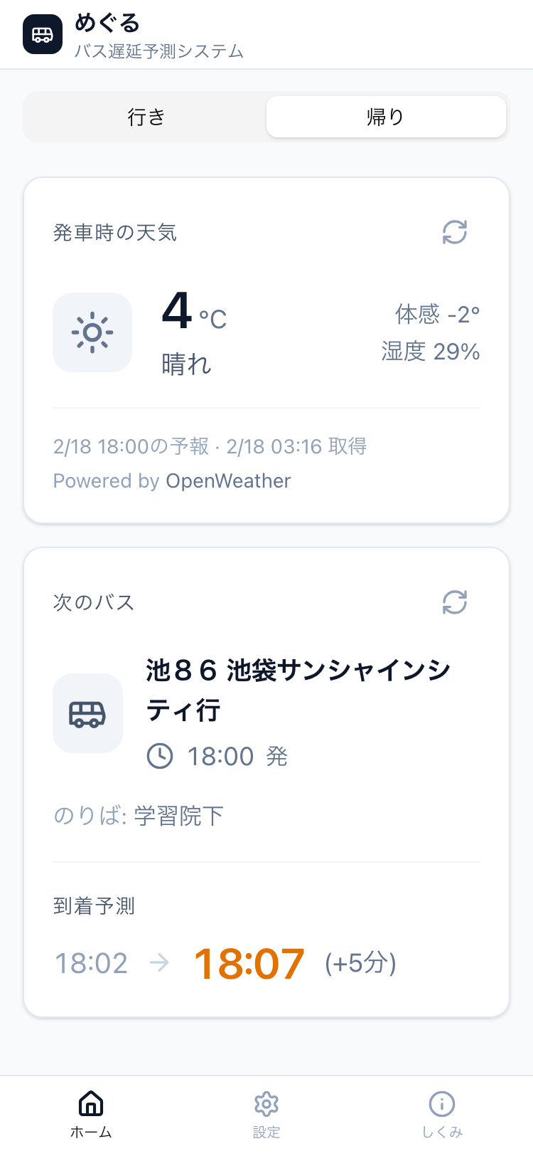
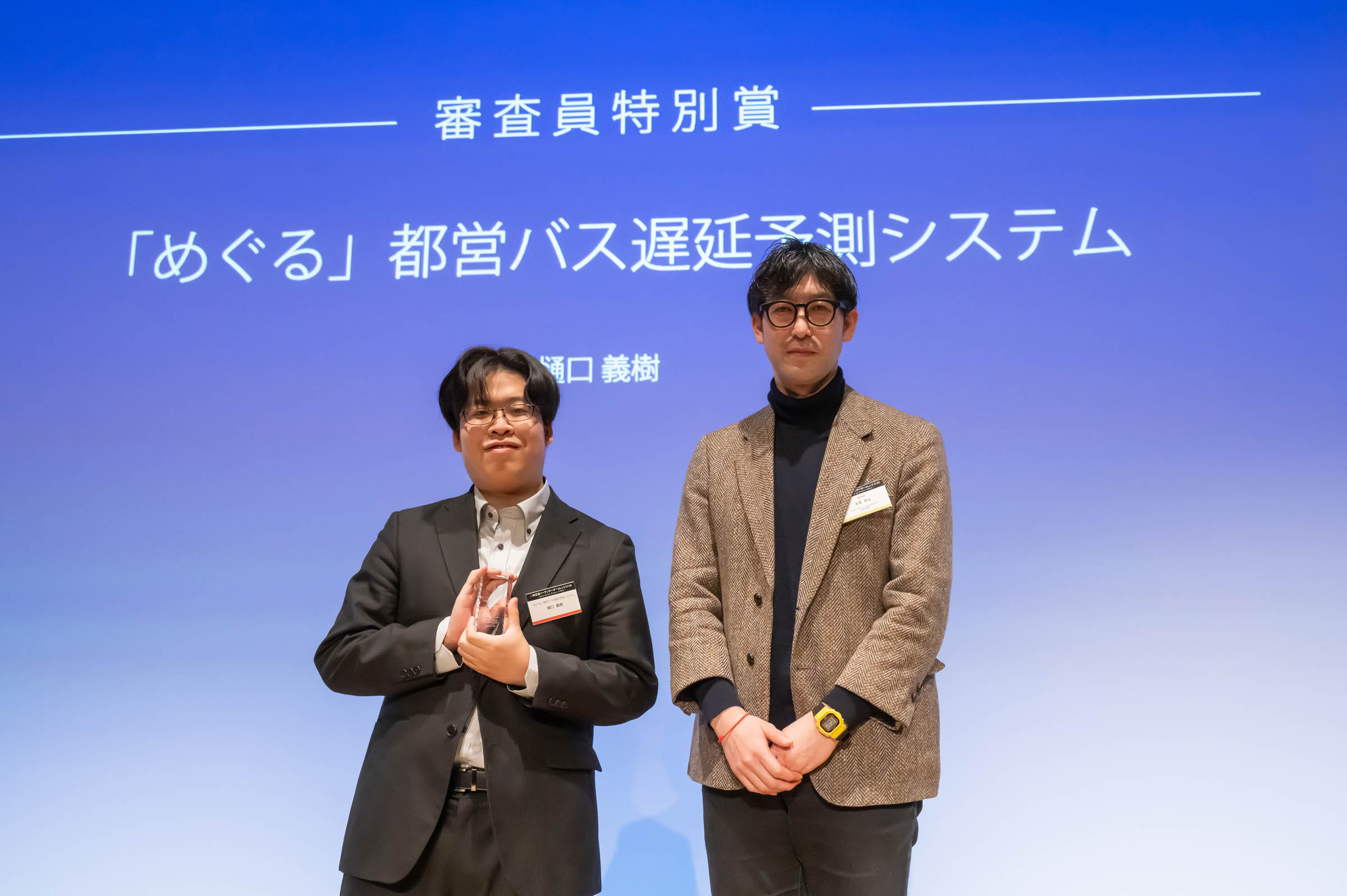
"Meguru" is a delay prediction application exclusively for Toei buses, which analyzes approximately 6.78 million bus real-time data points and weather data using machine learning.
By modeling the relationship between operational data and weather, it achieves highly accurate predictions tailored to the weather conditions of that particular time and day. It provides practical prediction values with an average error of about 1.5 minutes, allowing users to know the risk of delays in advance.
This contributes to reducing stress and improving convenience for bus users by assisting them in making more accurate travel plans.
Download
□web app
https://meguru.ratie.dev/
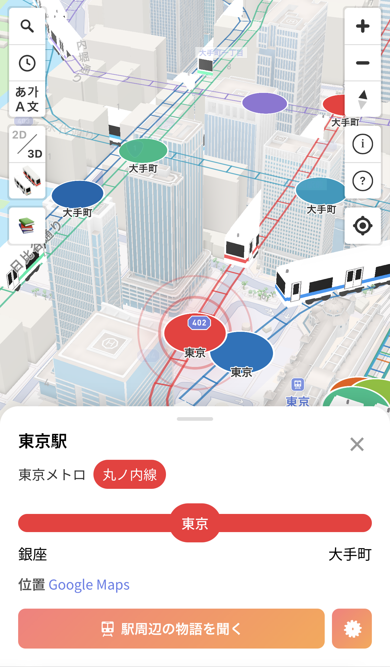
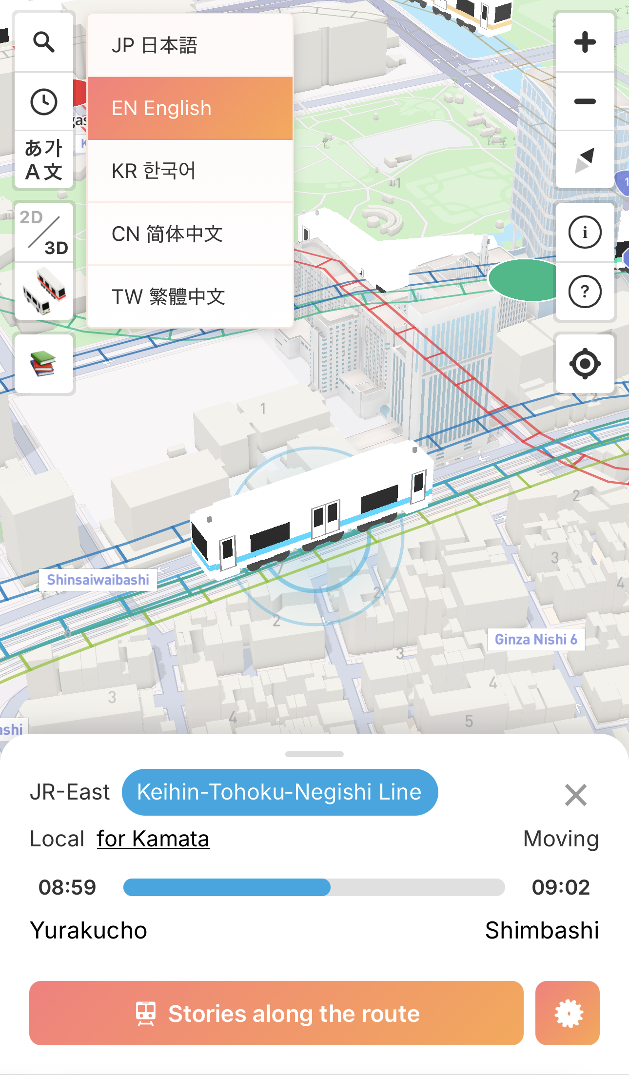
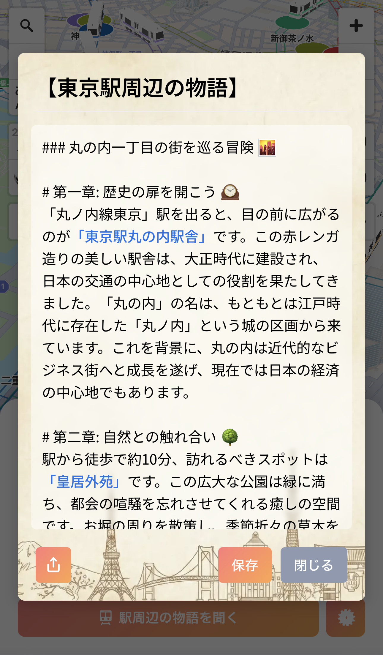
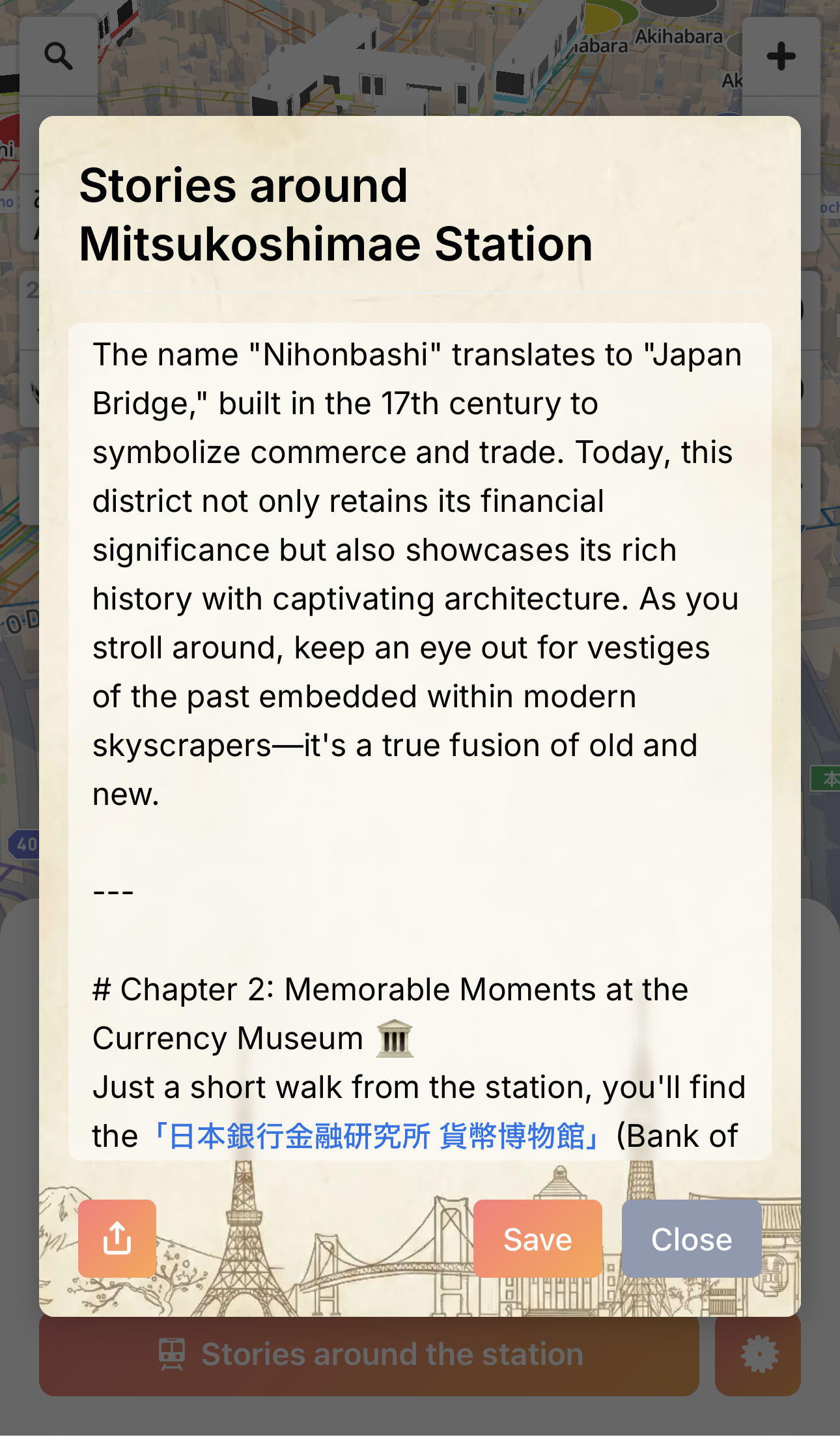
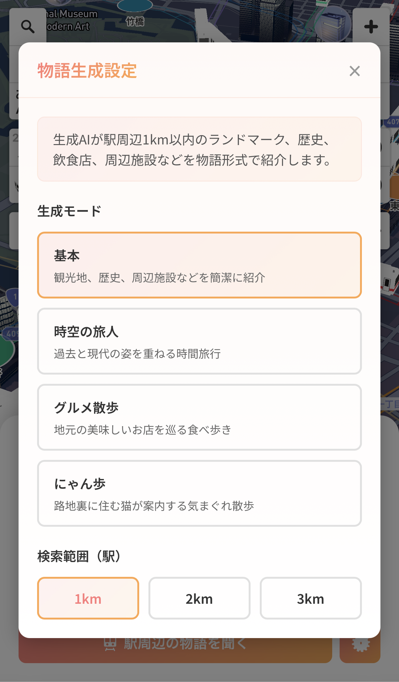
“EmoRoute” is an emotional mapping and navigation service that combines public transport data with generative AI to turn local charm into “stories.”
Using intuitive 2D/3D designs and multilingual support, the service removes information barriers for international visitors. Its key feature shows “local memories” and “secret spots” hidden by language gaps. By turning transport info into a narrative experience, EmoRoute transforms simple trips into memorable journeys and creates new travel demand.
Guides for landmarks and restaurants drive local spending and regional loyalty. Future updates will link congestion data with narrative recommendations to encourage off-peak travel, reducing overtourism while optimizing transportation demand.
Download
□web app
https://www.emoroute.com/
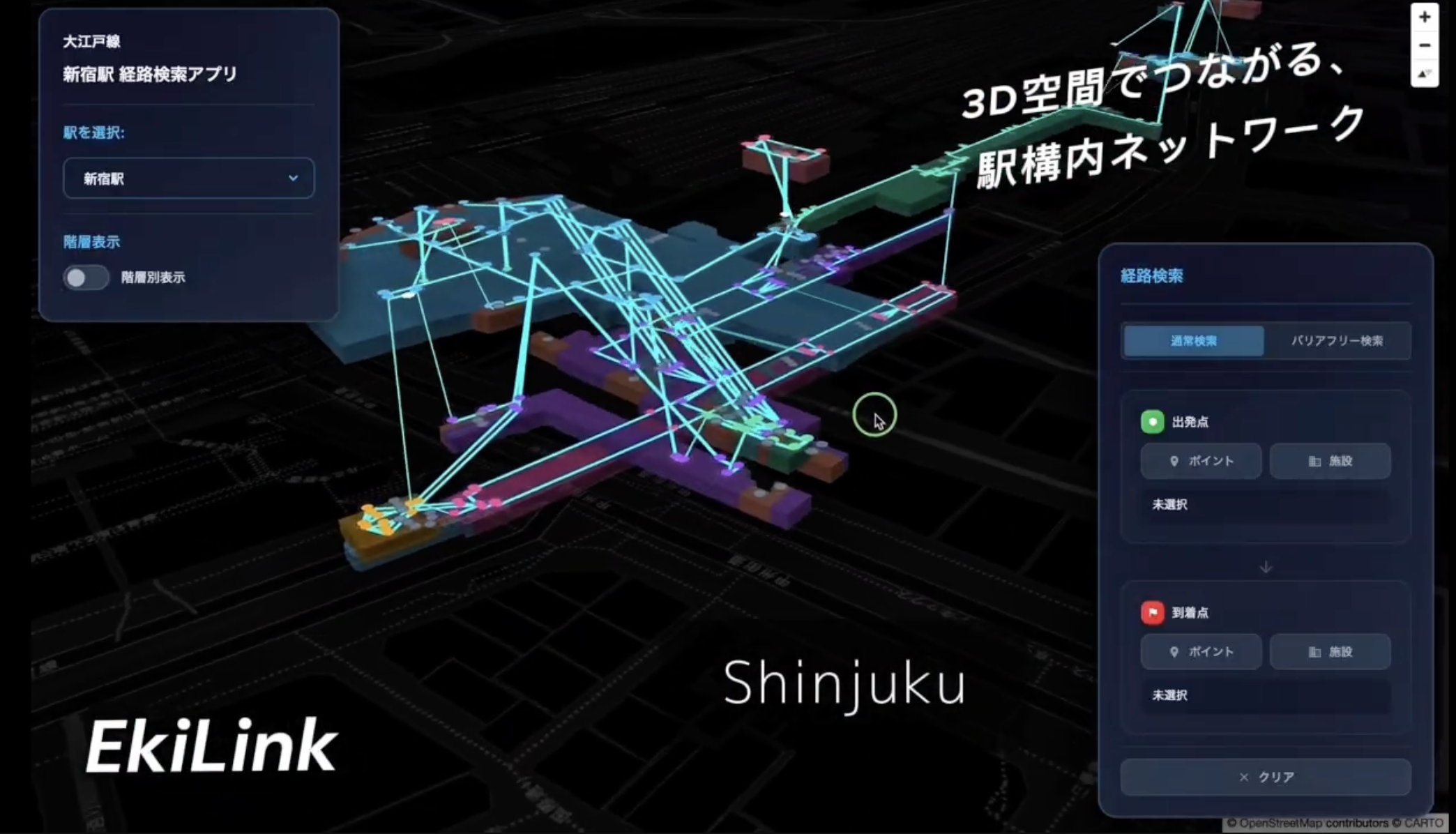
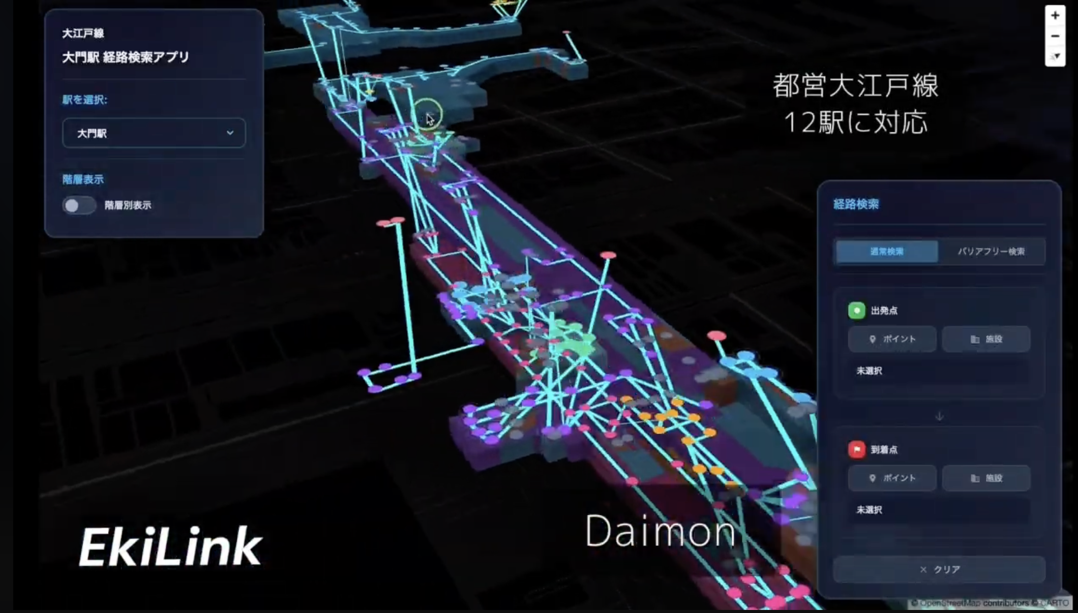
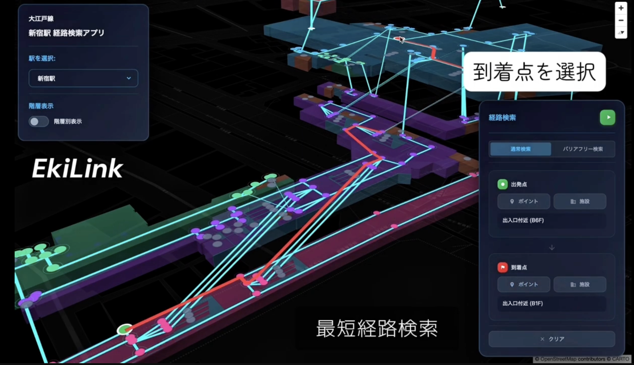
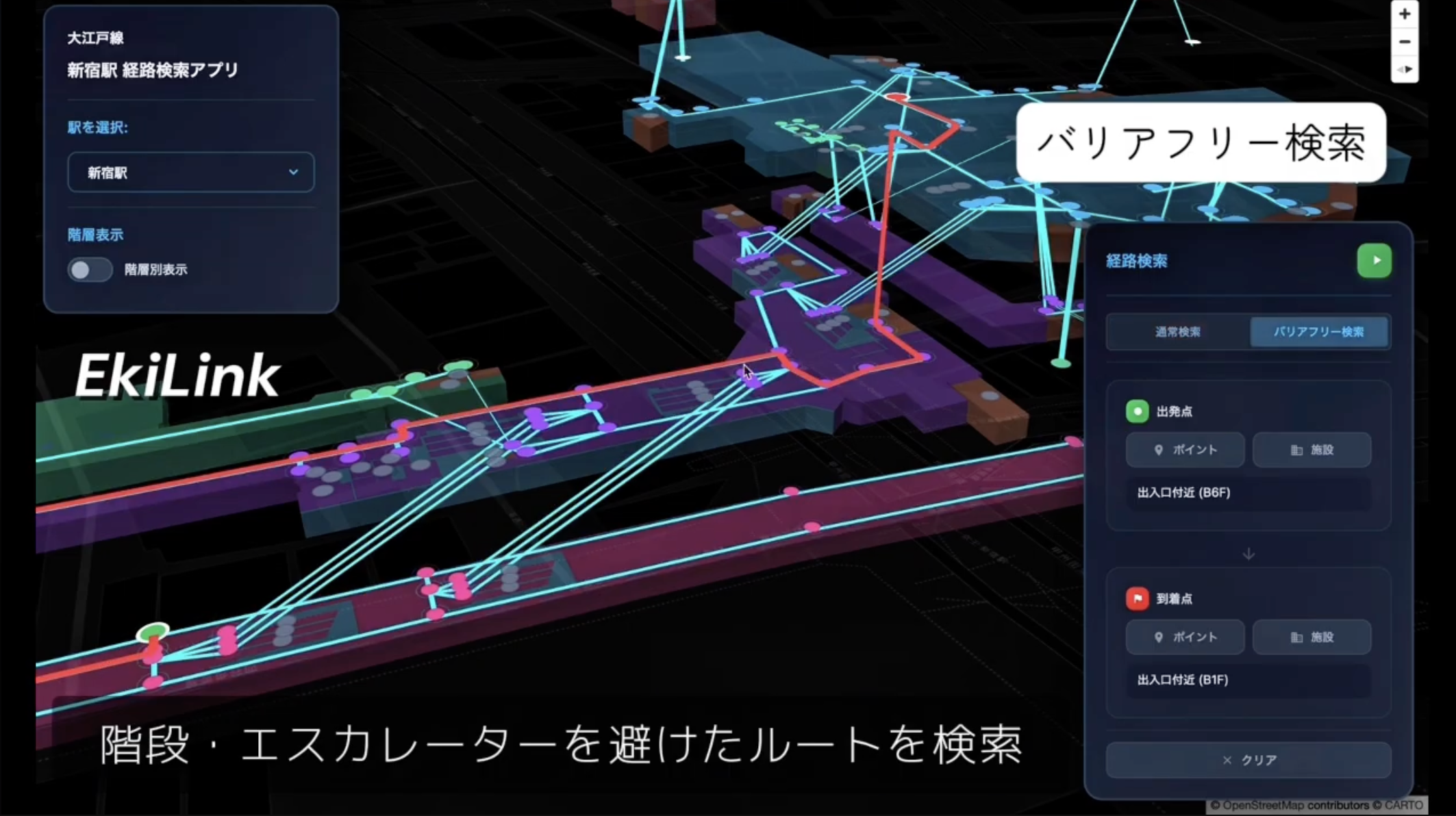
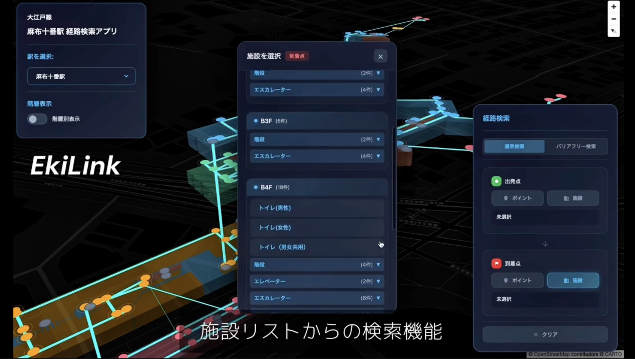
“EkiLink” is a 3D station navigation app focused on inclusive, barrier-free design. Utilizing official pedestrian network data, it visualizes complex station interiors and facilities in high-fidelity 3D. The app suggests safe routes that avoid stairs and escalators, specifically assisting wheelchair users, the elderly, and parents with strollers. By providing automated route animations, it ensures that anyone can navigate multi-level station structures with confidence and ease.
Download
□web app
https://ekilink.vercel.app/

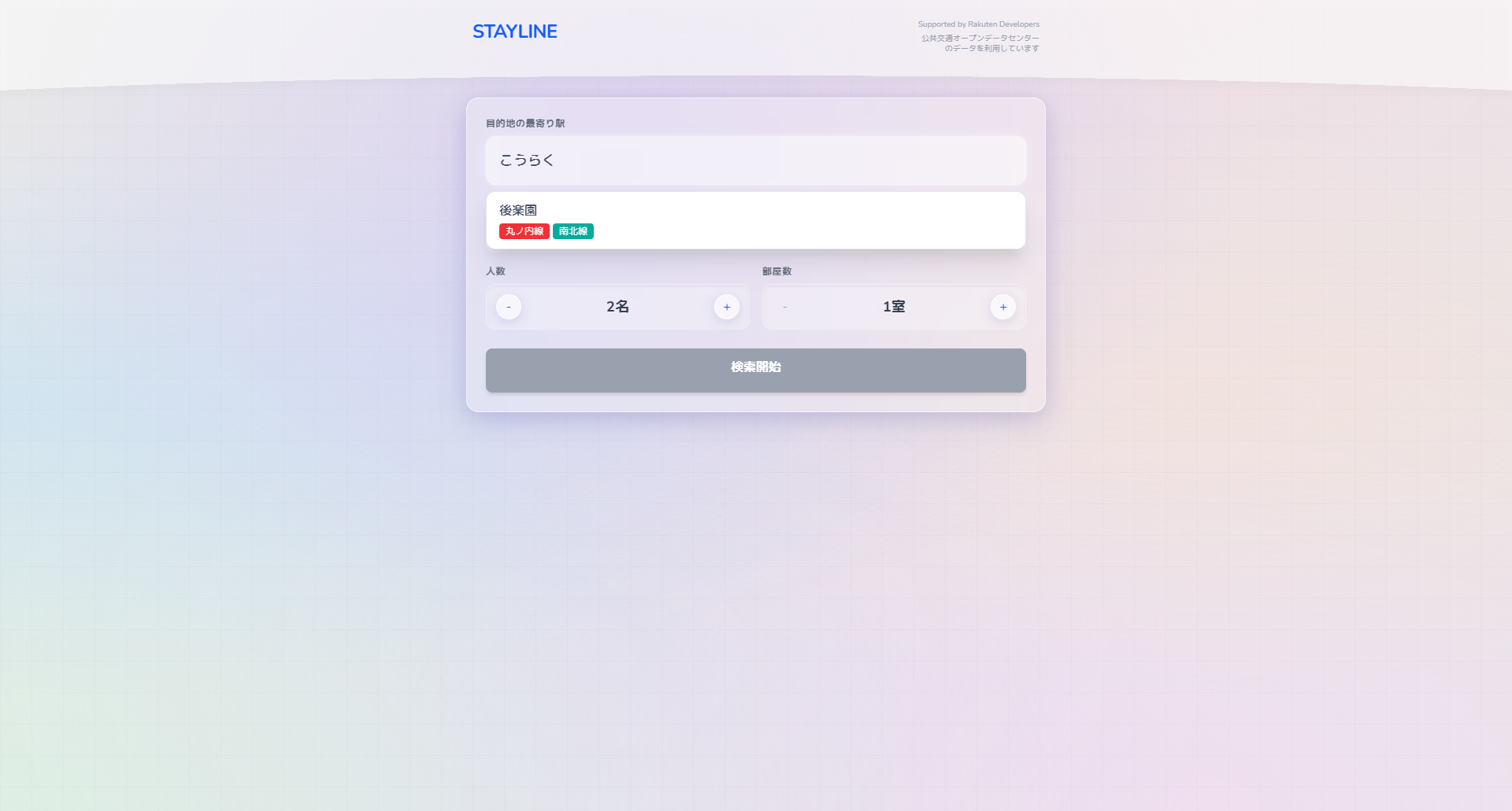
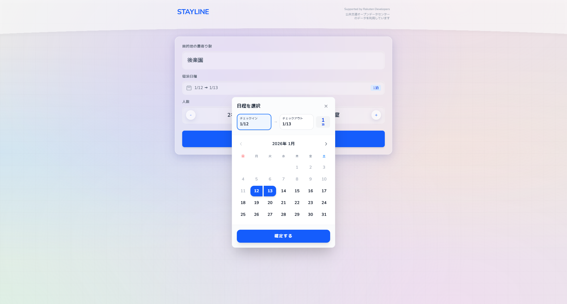
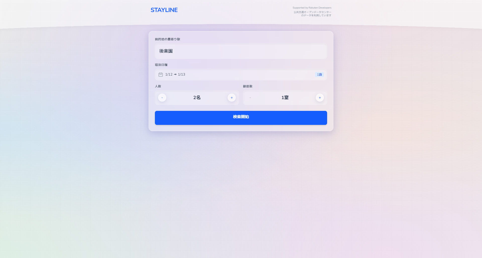
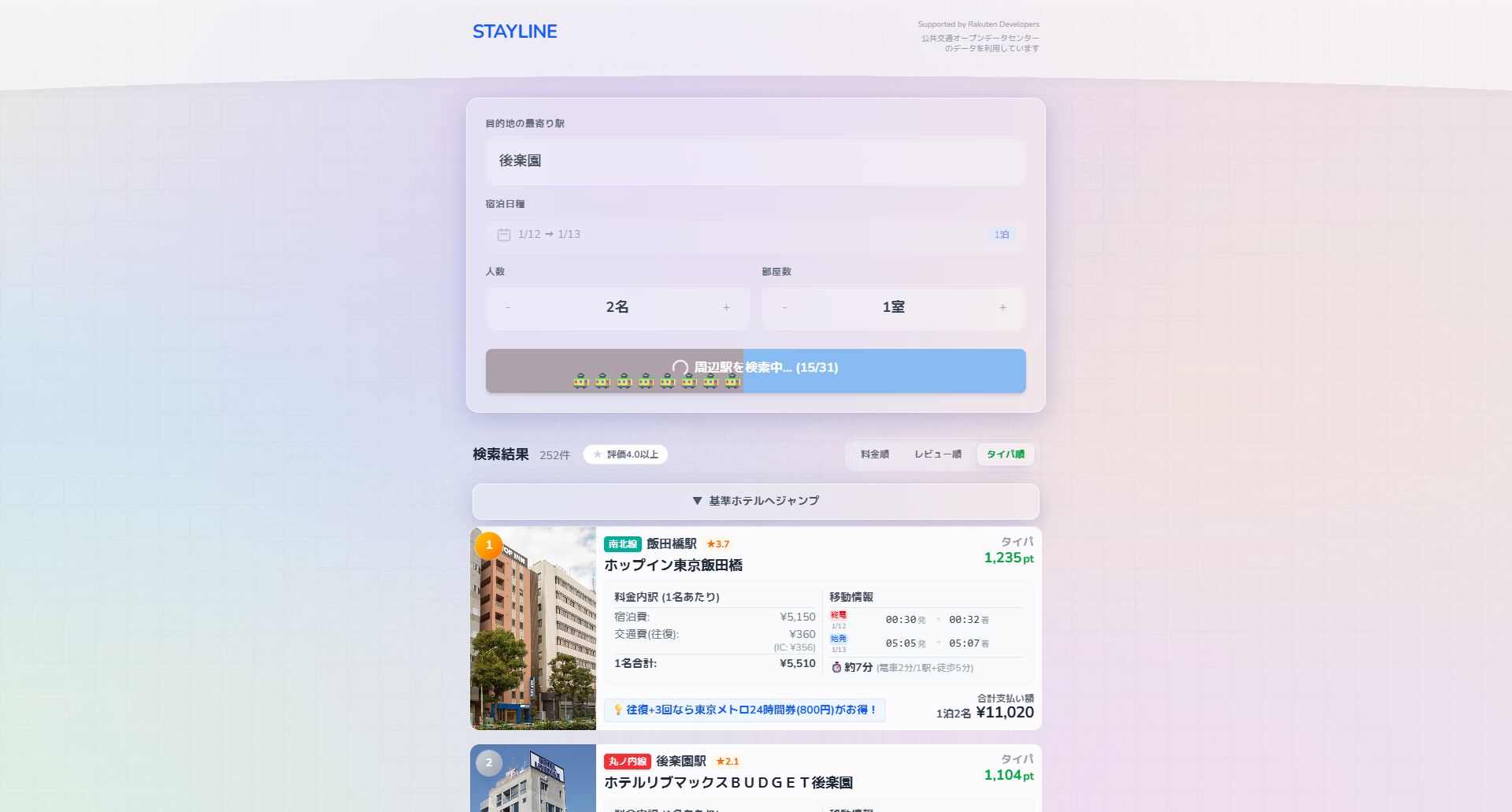
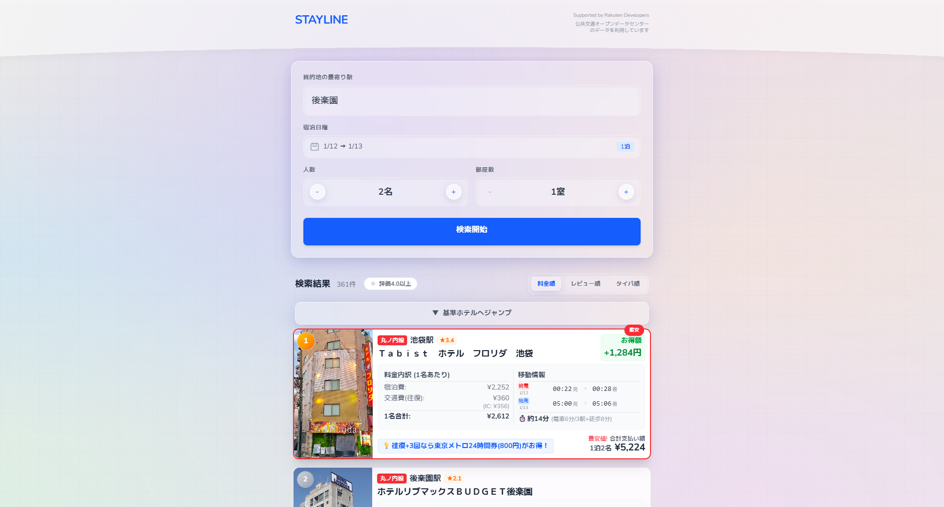
“STAYLINE” is a web application that redefines hotel searching by focusing on "Total Cost"—combining accommodation fees with round-trip transit fares and travel time. While popular event areas often suffer from high prices and low vacancy, hidden gems along the same train line remain overlooked. By integrating Tokyo Metro’s open data with hotel APIs, the app enables cross-regional searches based on transit routes. Featuring precise walking directions and last/first train alerts, it empowers users to find truly cost-effective stays while promoting sustainable tourism through the decentralization of lodging demand.
Download
□web app
https://search-hotels-seven.vercel.app/
“Suwa-Rail” is a transit navigation app that displays the probability of securing a seat alongside suggested route. In major metropolitan areas like Tokyo, while users can easily find the fastest route, many prioritize the comfort of sitting, even at the cost of extra time or fare. By integrating official timetable data with the "Metropolitan Transportation Census" from the Ministry of Land, Infrastructure, Transport and Tourism, the app simulates passenger flows at each station to calculate seat availability. It empowers commuters to choose comfort over speed, transforming the daily travel experience.
Download
□web app
https://suwa-rail.vercel.app/
"Meguru" is a delay prediction application exclusively for Toei buses, which analyzes approximately 6.78 million bus real-time data points and weather data using machine learning.
By modeling the relationship between operational data and weather, it achieves highly accurate predictions tailored to the weather conditions of that particular time and day. It provides practical prediction values with an average error of about 1.5 minutes, allowing users to know the risk of delays in advance.
This contributes to reducing stress and improving convenience for bus users by assisting them in making more accurate travel plans.
Download
□web app
https://meguru.ratie.dev/
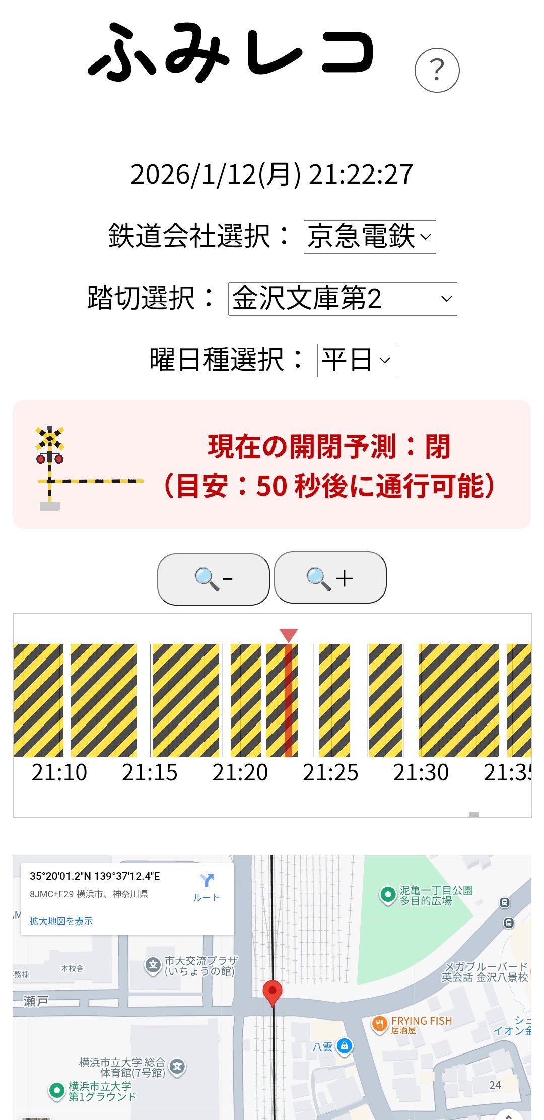
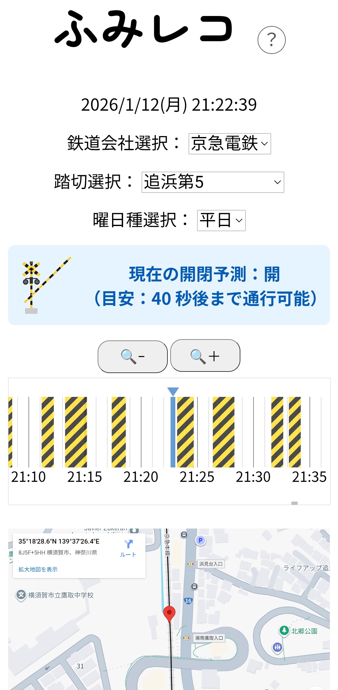
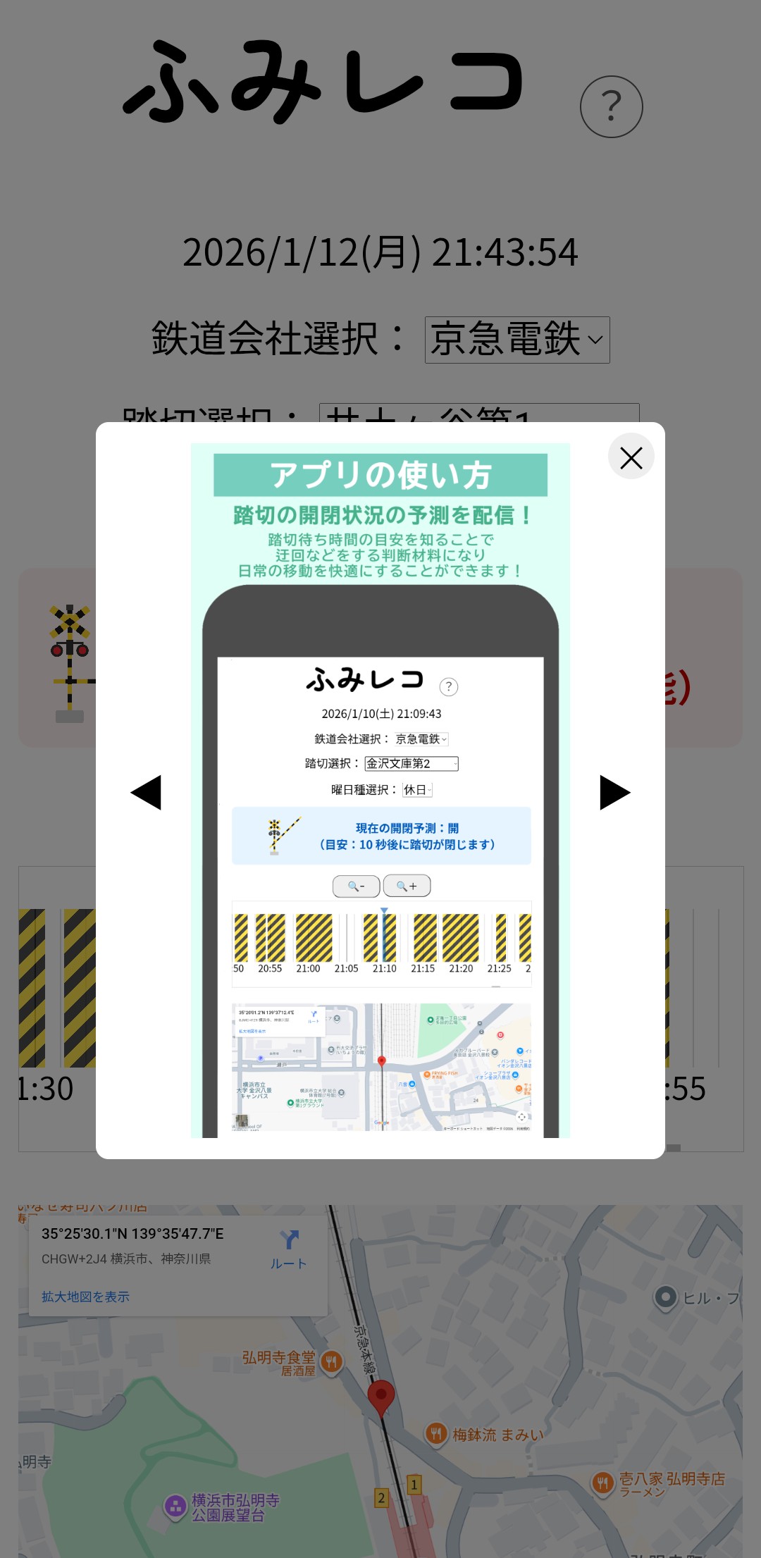
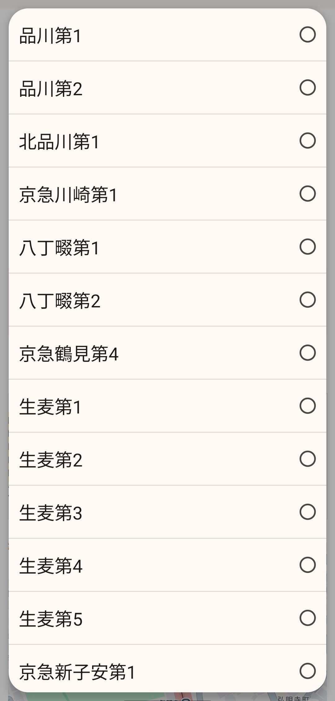
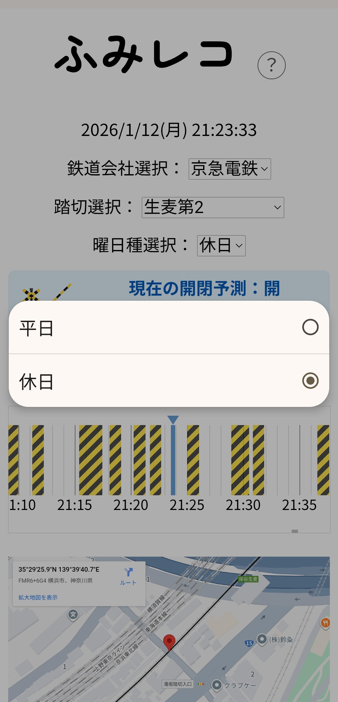
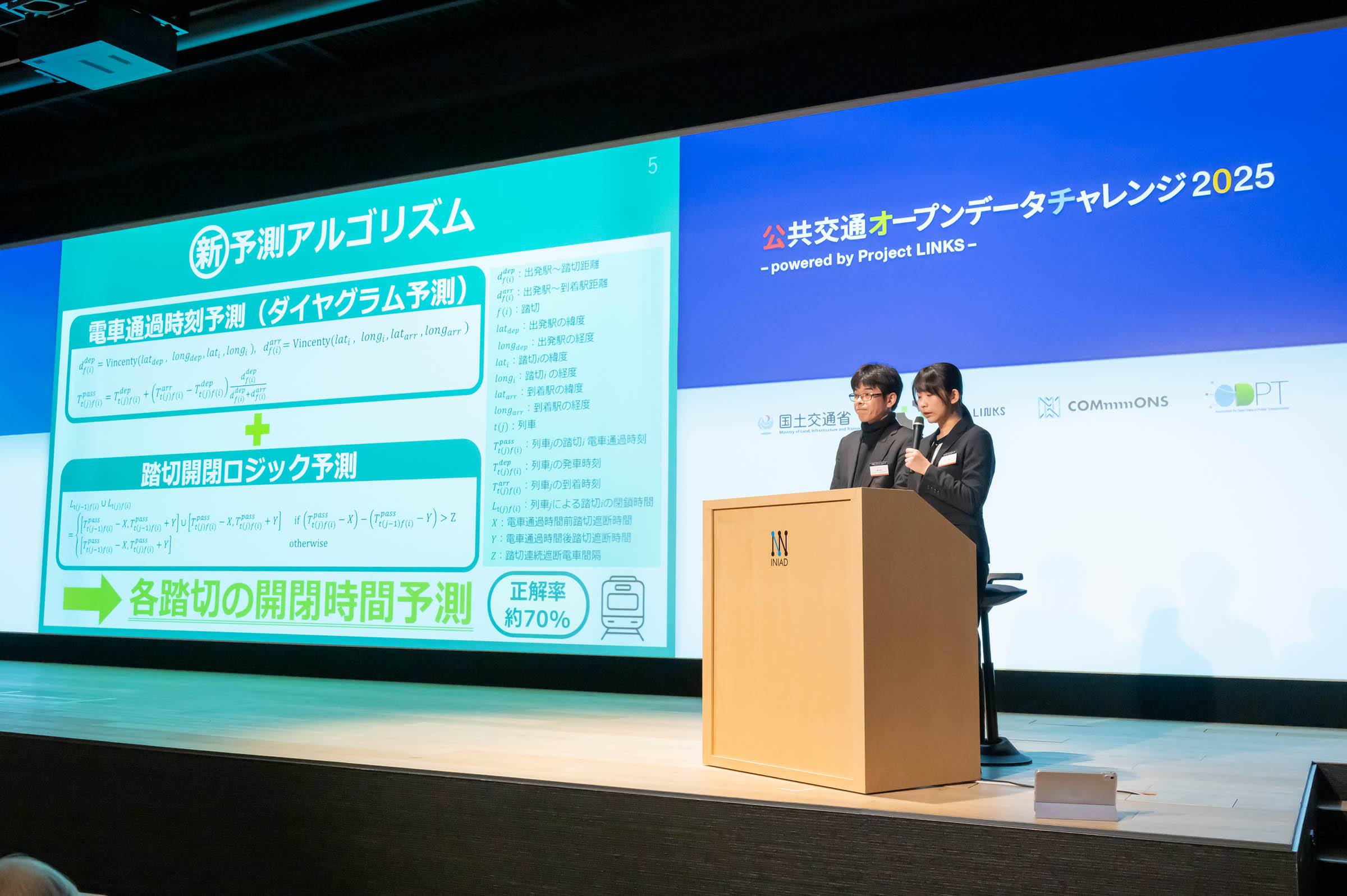
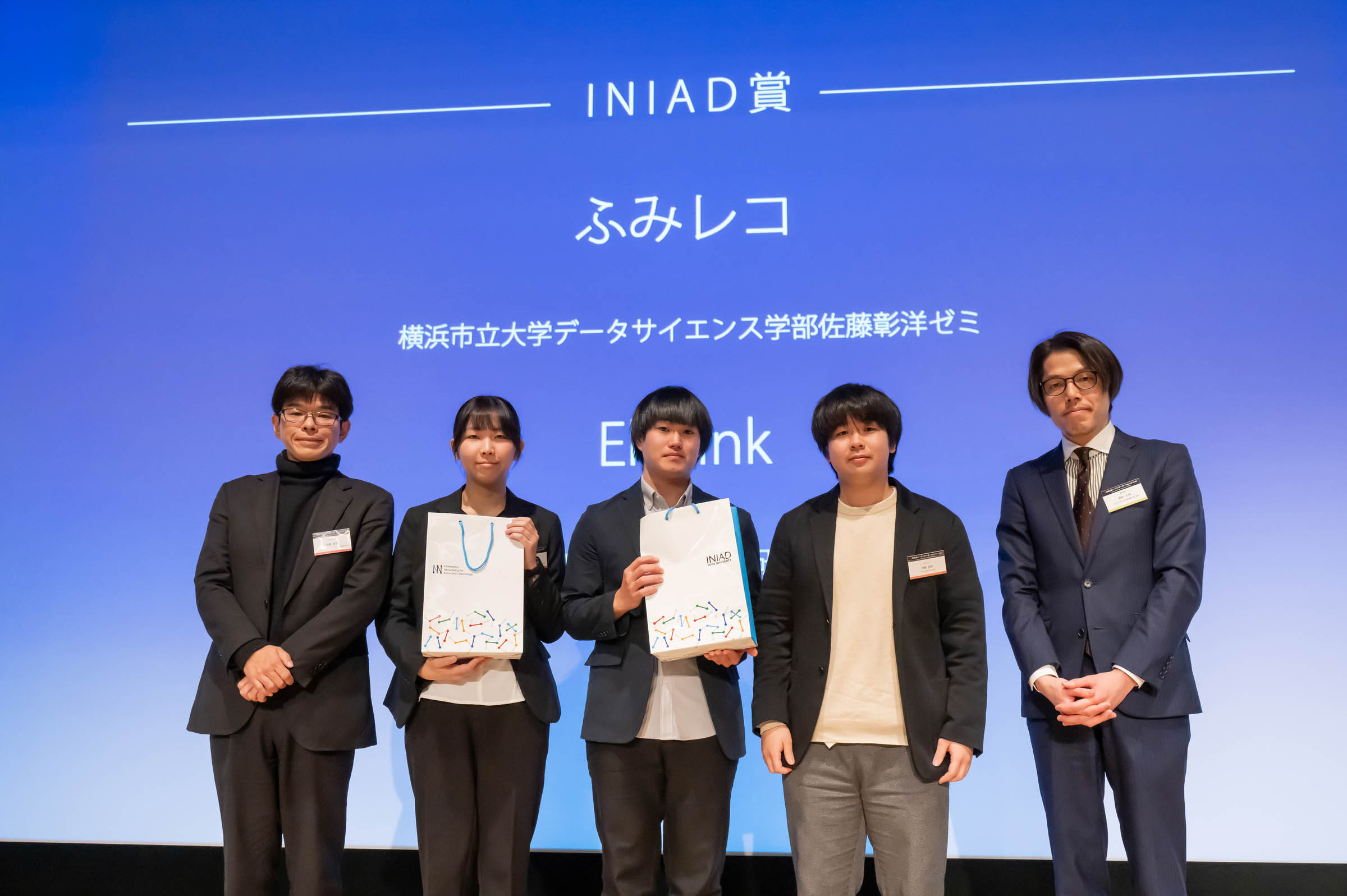
“FumiReco” is a navigation support app that visualizes the "invisible" inconvenience of waiting at railroad crossings. By calculating train passage times from real-time train location information and combining them with field-surveyed average gate durations, the app predicts crossing status through a unique model. It automatically detects the user’s nearest crossing on the Keikyu Main Line, displaying real-time status, a countdown to the next closure, and a 24-hour forecast timeline. By empowering users to decide whether to wait or detour, FumiReco aims to reduce travel stress and improve daily mobility experience more efficiently.
Download
“EkiLink” is a 3D station navigation app focused on inclusive, barrier-free design. Utilizing official pedestrian network data, it visualizes complex station interiors and facilities in high-fidelity 3D. The app suggests safe routes that avoid stairs and escalators, specifically assisting wheelchair users, the elderly, and parents with strollers. By providing automated route animations, it ensures that anyone can navigate multi-level station structures with confidence and ease.
Download
□web app
https://ekilink.vercel.app/